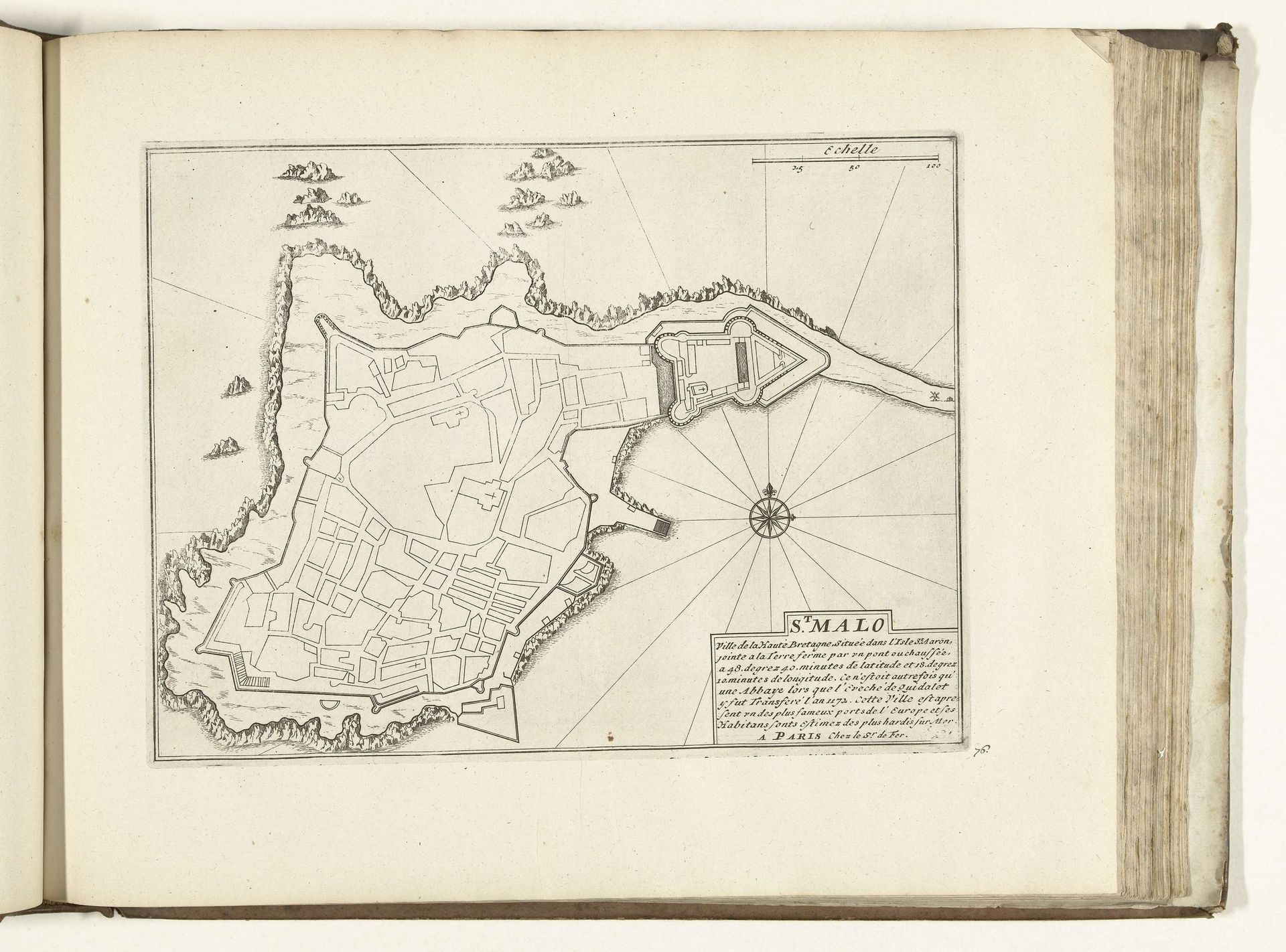
1726
Plattegrond van Saint-Malo, 1726
Anonymous
@anonymousLocation
RijksmuseumListen to curator's interpretation
Curatorial notes
This is a 1726 map of Saint-Malo, meticulously drawn anonymously. Observe how the compass rose at the heart of this map doesn’t just point towards navigation, but towards a deeper, more profound human quest for orientation. The compass, a symbol of guidance, finds its echoes in the labyrinthine structures of ancient Crete. It is fascinating to see how Saint-Malo, with its formidable walls and strategic coastal placement, embodies a collective aspiration for security. Fortified cities, such as this, appear time and again throughout history, revealing our constant negotiation between vulnerability and defense. The walls protect the space within from perceived external threats, mirroring the psychological need for boundaries. Reflect upon this image and see if it conjures up the timeless human drama of seeking safe harbor amidst life’s turbulent seas. It is a dance between anxiety and assurance. Such symbols recur in the human experience, surfacing through our art and across history.