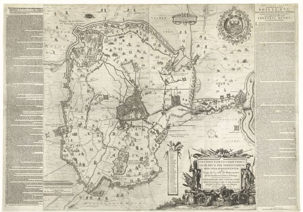
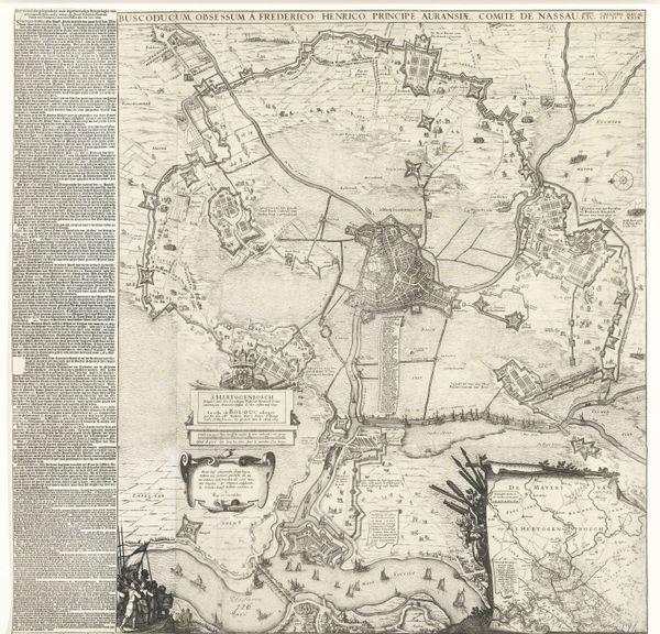
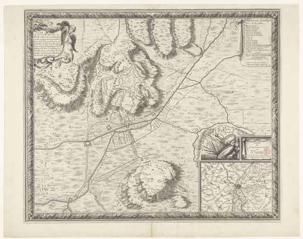
Grote kaart van het beleg van Den Bosch door Frederik Hendrik, 1629 1629
0:00
0:00
claesjanszvisscher
Rijksmuseum
print, engraving
#
baroque
# print
#
old engraving style
#
cityscape
#
history-painting
#
engraving
Dimensions: height 950 mm, width 1086 mm
Copyright: Rijks Museum: Open Domain
Claes Jansz. Visscher created this large map of the siege of Den Bosch in 1629 using engraving. The visual field is complex, dominated by intricate lines mapping fortifications, troop movements, and topographical details. The monochromatic palette focuses attention on the structural forms of the siege. The map's detailed rendering serves a dual purpose, both to document and to glorify military strategy. The siege is not merely represented but constructed as a legible, rational endeavor. Visscher uses semiotic codes of cartography and military symbolism to convey power and order. Consider how the seemingly objective lines of the map also function ideologically. They carve up space, define boundaries, and assert control, reflecting the period's broader concerns with territory and governance. The very act of mapping is an assertion of knowledge and domination. The ordered lines, therefore, serve not just a practical function but also a philosophical one, underscoring the power of representation and its impact on our understanding of the world.
Comments
No comments
Be the first to comment and join the conversation on the ultimate creative platform.
More like this