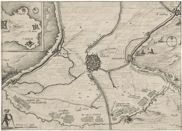
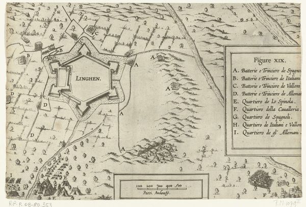
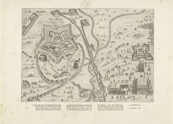
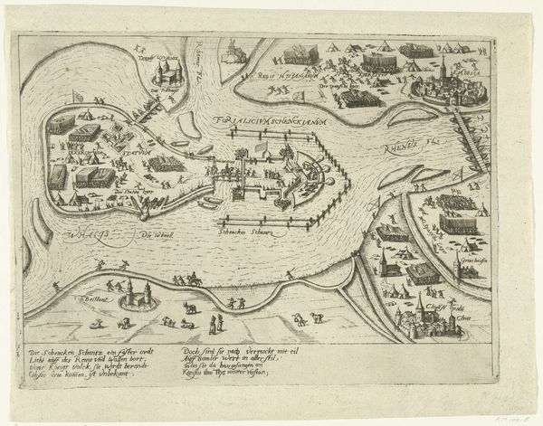
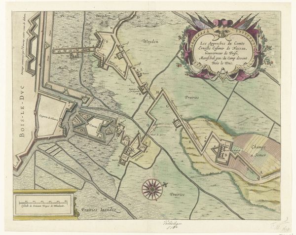
Plattegrond van Weissenburg tijdens het beleg van 1647 after 1647
0:00
0:00
print, metal, paper, engraving
#
medieval
# print
#
metal
#
old engraving style
#
paper
#
cityscape
#
history-painting
#
engraving
Dimensions: height 245 mm, width 328 mm
Copyright: Rijks Museum: Open Domain
Hanns Wilhelm Reutter von Blofeldt created this print titled 'Plattegrond van Weissenburg tijdens het beleg van 1647'. Note how the visual structure presents a detailed, almost clinical depiction of Weissenburg during its siege. The composition is dominated by precise lines forming the city's fortifications, with the surrounding landscape indicated by sparse, repetitive symbols for trees and military emplacements. The artwork functions less as a picturesque scene and more as a strategic document. The use of line and form serves a clear purpose: to map out the spatial relationships critical to military planning. Semiotically, each symbol acts as a signifier within a larger code of warfare and urban planning. Weissenburg's layout challenges fixed notions of space, turning the city into a complex network. The aesthetic value isn't in the beauty but in the articulation of power through spatial control. This print operates within a philosophical discourse where knowledge is power and representation is a tool for domination.
Comments
No comments
Be the first to comment and join the conversation on the ultimate creative platform.
More like this