print, engraving
#
dutch-golden-age
# print
#
line
#
cityscape
#
history-painting
#
engraving
Dimensions: height 477 mm, width 740 mm
Copyright: Rijks Museum: Open Domain
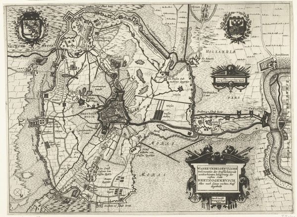
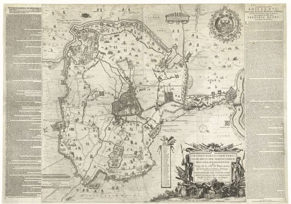
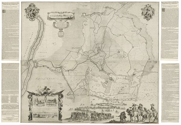
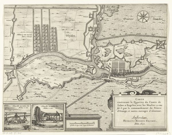
This print from 1629 depicts the siege of Den Bosch by Frederik Hendrik, and was created by an anonymous artist. It provides us with a fascinating glimpse into the cultural and political landscape of the Dutch Republic during the 17th century. Maps like these served a dual purpose. Firstly, they provided crucial information for military strategy, displaying fortifications, waterways, and troop movements, influencing how the battle unfolded. But these maps were also powerful tools of propaganda. They visually communicated the might and sophistication of the Dutch Republic, celebrating military victories and reinforcing a sense of national identity. The embellishments of heraldry and cartouches elevate the functional into a work of art, but one with a clear political message. The map speaks to the period's intense religious and political conflicts, with the Dutch Republic fighting for independence from Spanish rule. It's a reminder that even seemingly objective representations of space are shaped by the social and political contexts in which they are created. To fully understand the meaning of this map, we must look at archival sources, military histories, and political pamphlets from the time. The study of art is always contingent on understanding its broader historical context.
Comments
No comments
Be the first to comment and join the conversation on the ultimate creative platform.
More like this