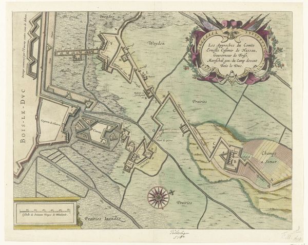
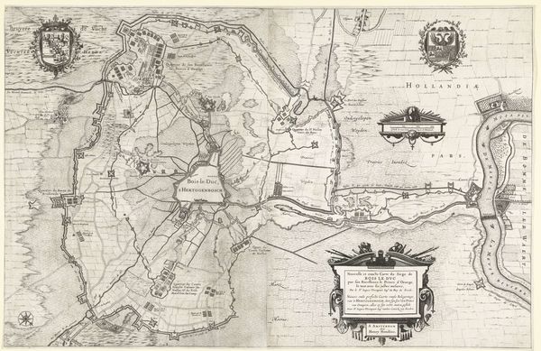
Loopgraven van het Staatse leger onder Brederode tot aan Fort Pettelaer tijdens het beleg van Den Bosch, 1629 1629 - 1630
0:00
0:00
drawing, ink
#
drawing
#
dutch-golden-age
#
ink
#
cityscape
#
history-painting
Dimensions: height 283 mm, width 360 mm
Copyright: Rijks Museum: Open Domain
This map, made in 1629, depicts the siege of Den Bosch, charting the military entrenchments snaking towards Fort Pettelaer. Note the compass rose: a symbolic guide, a reference to man's quest for orientation and control over his environment. It reminds us of similar navigational symbols in ancient world maps. Yet, while the compass should guide, the chaotic lines of the fortifications evoke something more primal: fear and desperation. The labyrinth of trenches, much like Daedalus’s maze, suggests a descent into the subconscious. In mirroring these historical roots and echoing in modern psychological understanding, we are reminded how such cartographic representations capture more than geographical data. They also reflect humanity's enduring struggle between order and chaos, knowledge and the unknown, deeply rooted in our collective memory.
Comments
No comments
Be the first to comment and join the conversation on the ultimate creative platform.
More like this