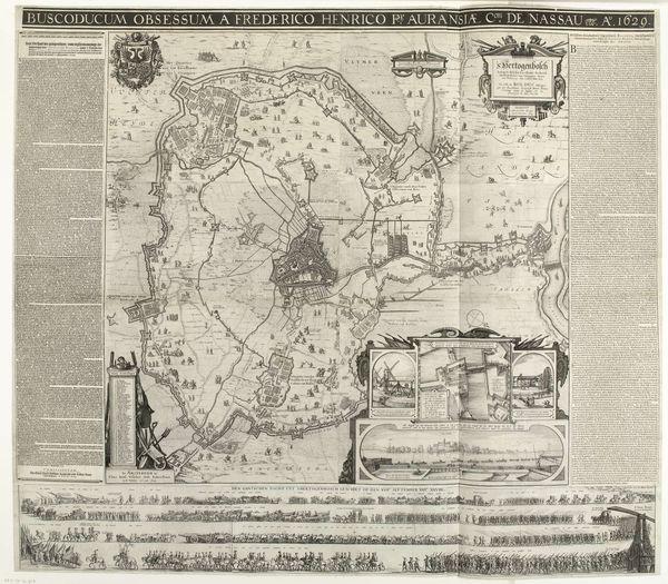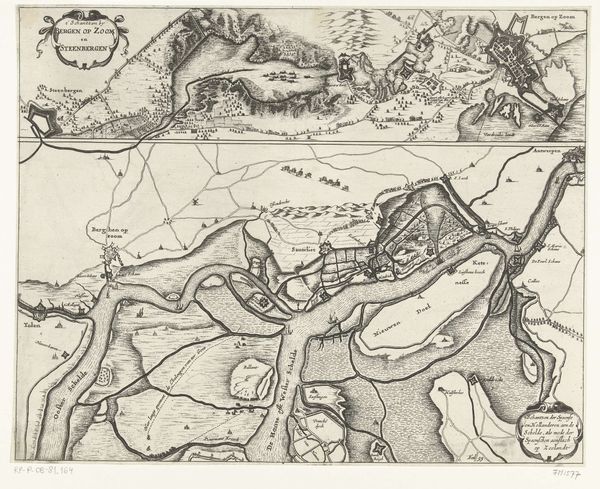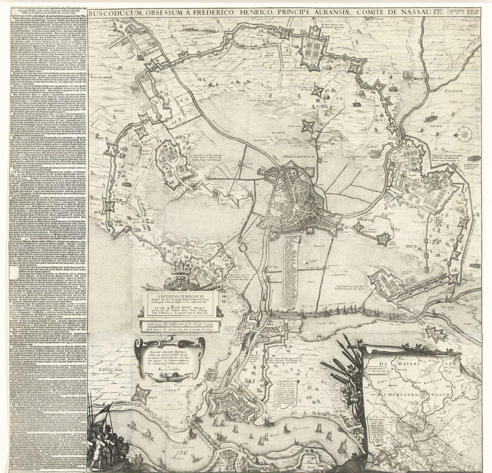
1629
Grote kaart van het beleg van Den Bosch door Frederik Hendrik, 1629
Claes Jansz. Visscher
1586 - 1652Location
RijksmuseumListen to curator's interpretation
Curatorial notes
Claes Jansz. Visscher produced this print in 1629, a grand depiction of Frederik Hendrik's siege of Den Bosch. More than just a record, this map is a potent assertion of Dutch power amidst the Eighty Years' War. Made in the Netherlands, its meticulous detail reflects the Dutch Republic's burgeoning map-making industry and its role in shaping national identity. The map's visual codes, such as strategic fortifications and troop placements, speak to the military tactics of the era. The surrounding text accounts for the social conditions that made the siege possible. As a historian, I look to archives, military records, and even personal letters to understand how events like this shaped social structures and political movements. In understanding the cultural and institutional contexts, the role of maps as tools of power and national narrative becomes clear.