drawing, print, ink, engraving
#
drawing
#
baroque
# print
#
ink
#
geometric
#
cityscape
#
history-painting
#
academic-art
#
engraving
Dimensions: height 400 mm, width 522 mm
Copyright: Rijks Museum: Open Domain
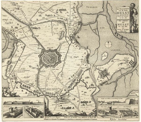
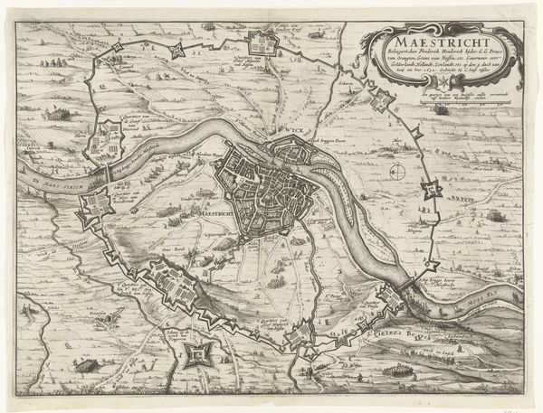
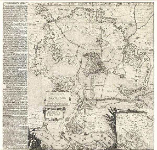
This etching by Pieter Hendricksz. Schut depicts the siege of Aire-sur-la-Lys in 1641. Produced in the Netherlands, the map offers a bird's-eye view of the fortified city and the surrounding military encampments during a pivotal moment in the Eighty Years' War. Cartography in the 17th century was more than just a tool for navigation. It was a political instrument, asserting territorial claims and documenting military campaigns. This map, with its detailed rendering of fortifications and troop positions, reflects the Dutch Republic’s strategic interests in the region. Such images were used to inform public opinion, shape national identity and bolster support for military endeavors. They were commissioned by the government, and circulated widely as prints. Studying the social conditions that shaped artistic production helps us see how this map served as a form of propaganda, solidifying the Dutch Republic’s sense of itself as a powerful, expansionist force. To gain a deeper understanding, one might consult military archives, period newspapers, and political pamphlets.
Comments
No comments
Be the first to comment and join the conversation on the ultimate creative platform.
More like this