graphic-art, print, engraving
#
graphic-art
# print
#
landscape
#
geometric
#
line
#
history-painting
#
engraving
Dimensions: height 141 mm, width 185 mm
Copyright: Rijks Museum: Open Domain
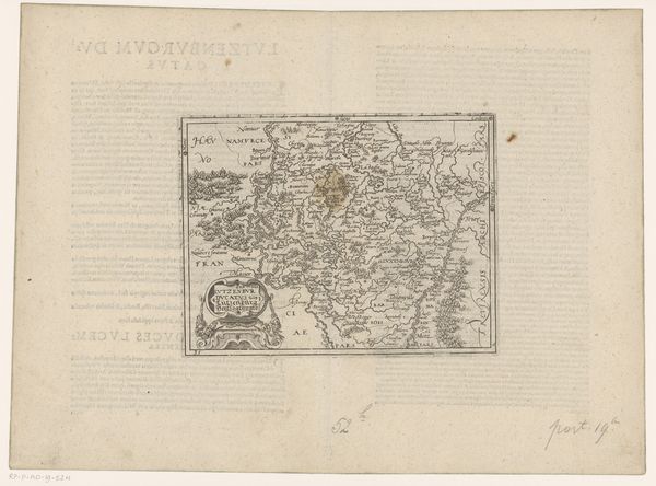
Frans Hogenberg created this map of the Prince-Bishopric of Liège in approximately 1570 using engraving. Hogenberg was working during a time of significant religious and political conflict in Europe, particularly in the Low Countries, which were then under Spanish rule. As the region dealt with religious reform and the rise of Protestantism the detailed mapping of territories became a tool not just for navigation but for asserting control and understanding the landscape of power. Hogenberg's maps, with their precise detailing of cities and borders, reflected an effort to define and claim territories amidst shifting allegiances. How did the people living in the region experience this mapping? For those whose lives were directly impacted by the redrawing of boundaries, this map may have been a source of anxiety about how political and religious upheaval was disrupting their sense of home and identity. This is more than just geography; it's a visualization of a society in flux.
Comments
No comments
Be the first to comment and join the conversation on the ultimate creative platform.
More like this