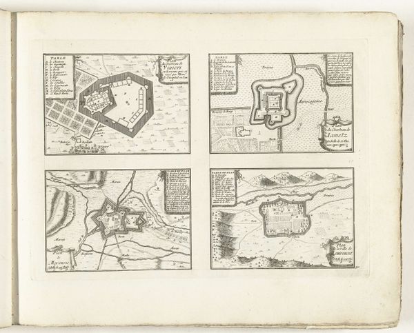
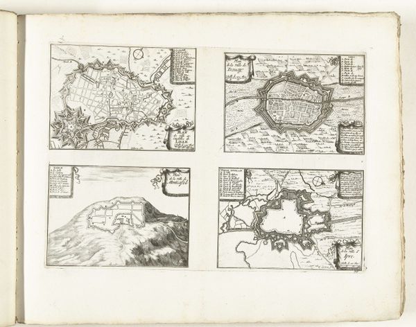
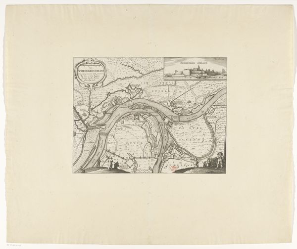
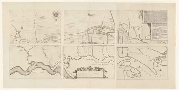
Plattegrond van Nieuwstadt, Geldern, Straelen, Wachtendonk en Erkelenz en een gezicht op Montfort 1672
0:00
0:00
nicolaesvangeelkercken
Rijksmuseum
drawing, print, ink, engraving
#
drawing
#
baroque
#
dutch-golden-age
# print
#
ink
#
cityscape
#
engraving
Dimensions: height 250 mm, width 347 mm, height 124 mm, width 340 mm, height 412 mm, width 379 mm
Copyright: Rijks Museum: Open Domain
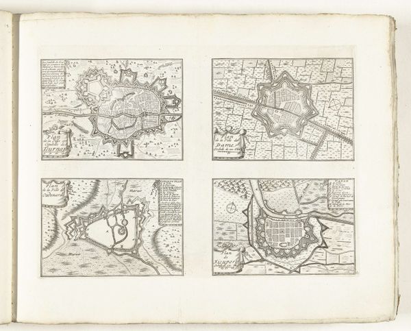
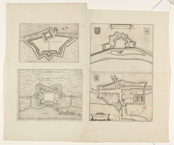
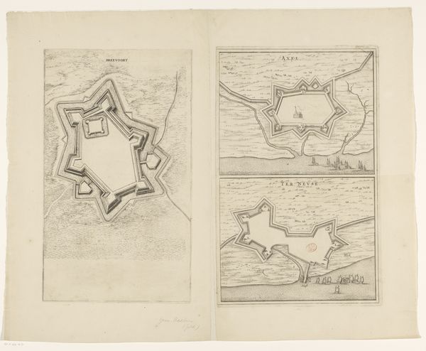
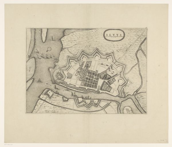
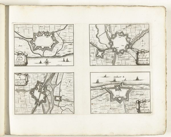
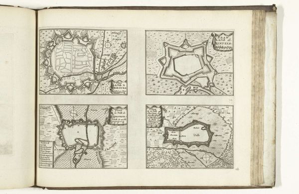
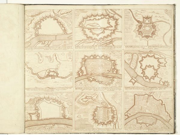
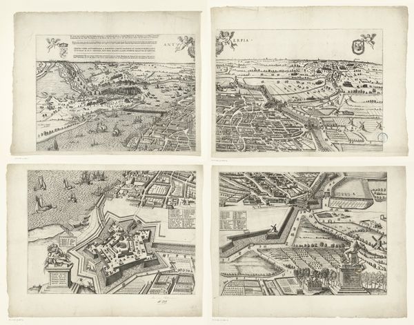
Nicolaes van Geelkercken made this print of Nieuwstadt, Geldern, Straelen, Wachtendonk en Erkelenz en een gezicht op Montfort. What we see here are town plans, made in the Netherlands, at a time of intense political and military conflict. The Dutch Republic was fighting for independence from Spain, and the control of towns like these was vital. The image shows us not just the towns themselves but also the way they were fortified – you can see the elaborate systems of walls and moats designed to keep invaders out. It is a fascinating window into the military and political strategies of the 17th century. These are not just maps, they are tools of war. A historian would want to research the military campaigns that took place in these towns, and the strategies used by both sides. What can these bird’s eye views tell us about the way these towns functioned, both as military outposts and as civilian centres?
Comments
No comments
Be the first to comment and join the conversation on the ultimate creative platform.
More like this