drawing, print, paper, ink, engraving
#
drawing
#
baroque
# print
#
paper
#
ink
#
cityscape
#
engraving
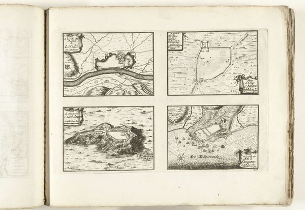
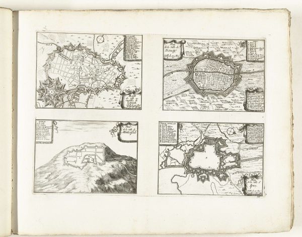
Dimensions: height 239 mm, width 339 mm
Copyright: Rijks Museum: Open Domain
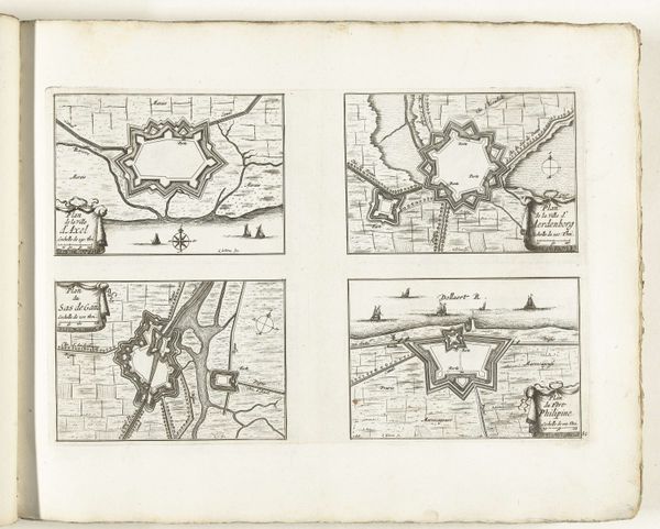
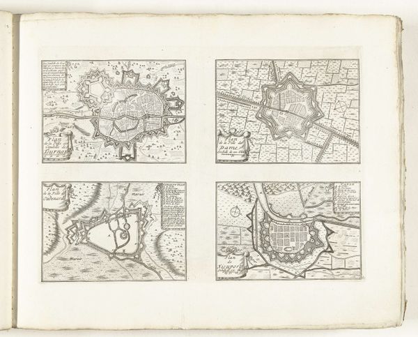
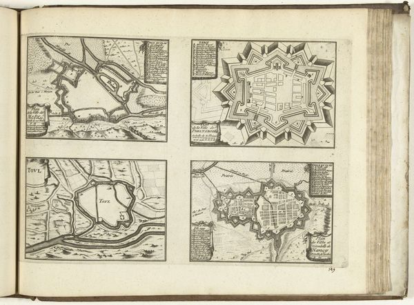
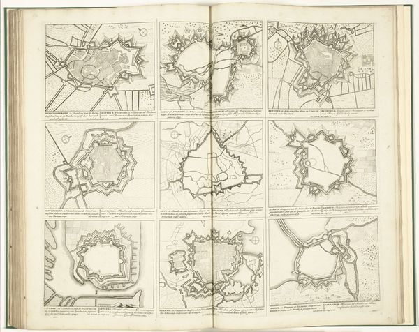
This engraving from 1726 presents the plans of Fribourg, Benfeld, Haguenau and Stollhofen, all made by an anonymous artist. The images depict fortified towns, visualising the strategic priorities of early modern Europe. These maps reflect the culture of military engineering that shaped the continent during this period. Each town is represented as a stronghold, the layouts emphasize defense and control. The star-shaped fortifications were designed to offer maximum resistance to attackers, a clear indication of the constant threat of war and siege. What's particularly interesting is how these plans also demonstrate the power of cartography as an instrument of the state. These weren't made for public consumption but were likely commissioned by military or governmental bodies. The control and planning of space was a way to control and govern society. To understand these images fully, historians consult military archives, engineering treatises, and state records, piecing together the social and political context. The image’s meaning is contingent on understanding the institutional forces that shaped its creation.
Comments
No comments
Be the first to comment and join the conversation on the ultimate creative platform.
More like this