Plattegronden van Lille, Douai, Montcassel en Yperen, ca. 1702 1702 - 1703
0:00
0:00
laurensscherm
Rijksmuseum
drawing, print, ink, engraving
#
drawing
#
baroque
# print
#
ink
#
geometric
#
pen-ink sketch
#
cityscape
#
engraving
Dimensions: height 240 mm, width 339 mm
Copyright: Rijks Museum: Open Domain
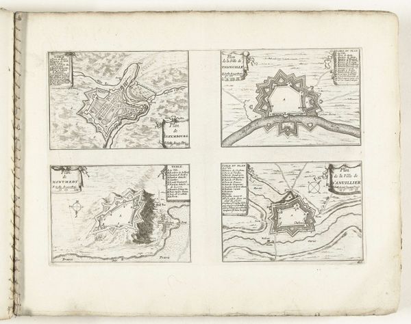
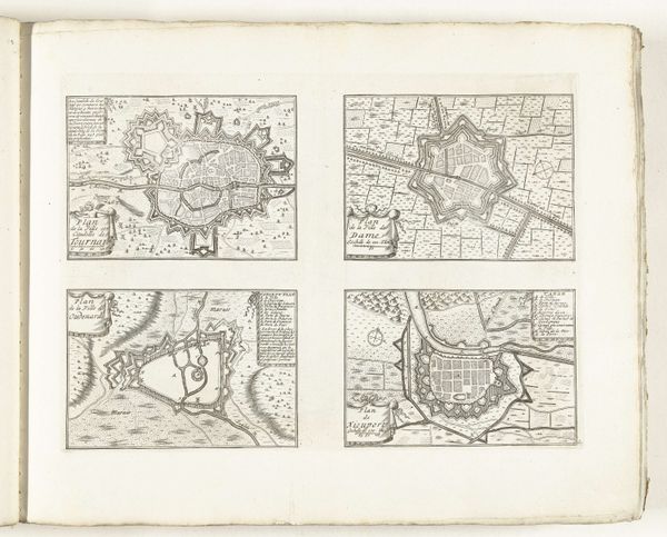
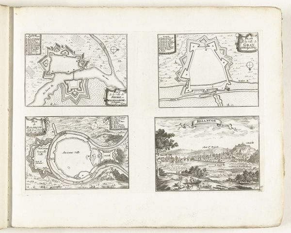
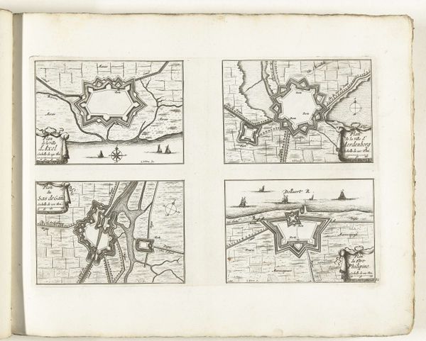
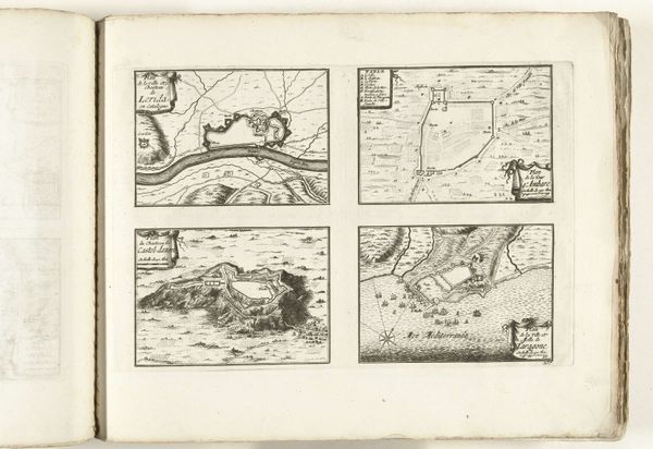
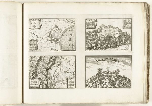
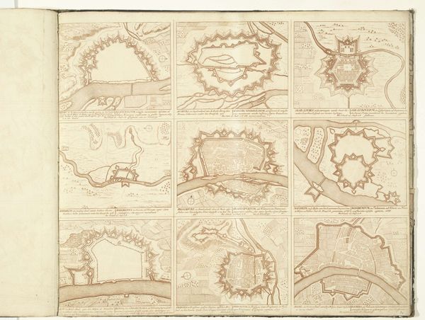
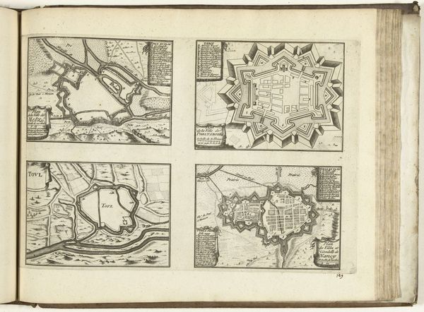
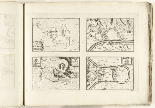
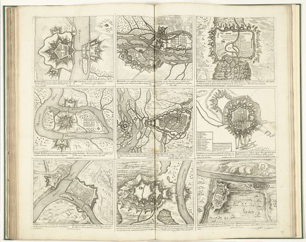
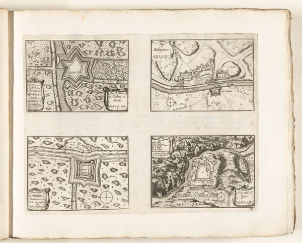
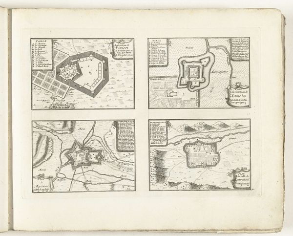
Laurens Scherm made this print of Lille, Douai, Montcassel and Yperen around 1702. At first glance, these appear to be straightforward maps, but they are products of a very specific time and place. Made in the Netherlands during the War of the Spanish Succession, these aren't just geographical records, they are strategic military documents, tools designed for planning sieges and defenses. Notice the detailed fortifications surrounding each city. The Dutch Republic was a major player in European politics and warfare and the control of these cities, located in what is now Northern France and Belgium, was crucial. Scherm, as an artist, was thus contributing to the war effort. To understand this print fully, we need to look at the political and military history of the period. Where were the frontlines? Which powers controlled these cities at different times? Understanding the history that produced them is as essential as the ink and paper itself.
Comments
No comments
Be the first to comment and join the conversation on the ultimate creative platform.
More like this