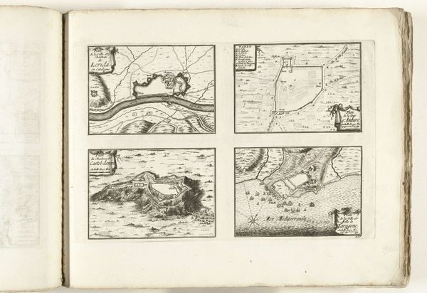
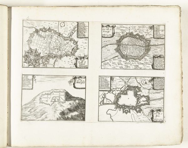
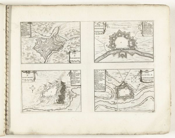
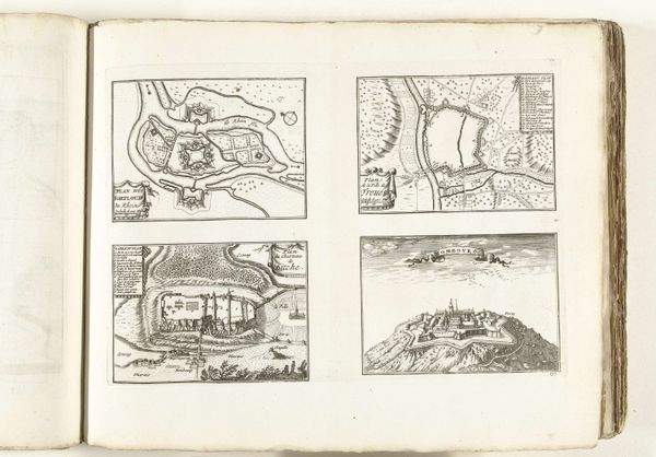
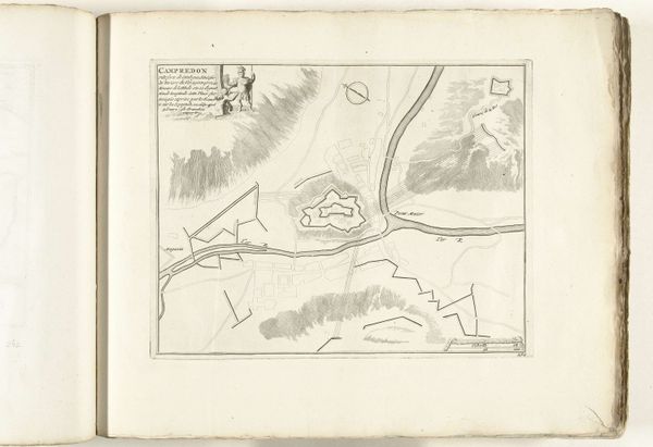
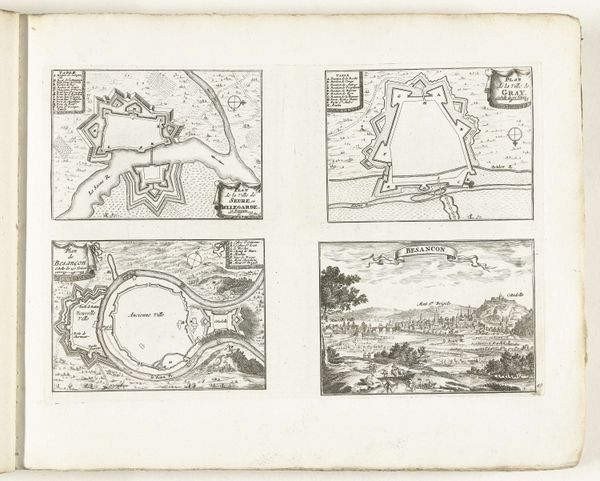
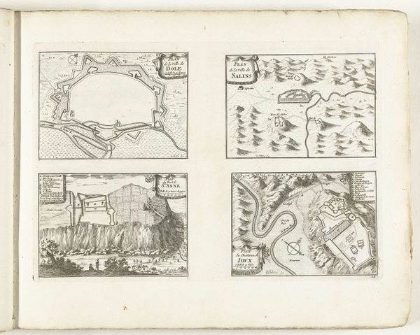
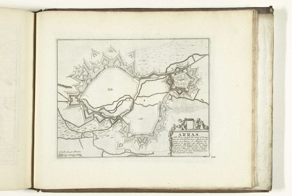
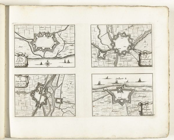
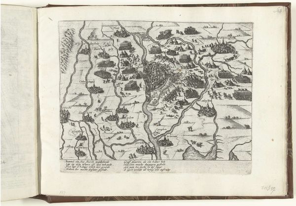
Plattegronden van Rosas, Gerona en andere plaatsen in Catalonië, ca. 1702 1702 - 1703
0:00
0:00
anonymous
Rijksmuseum
drawing, print, ink, engraving
#
drawing
#
baroque
# print
#
pen sketch
#
sketch book
#
ink
#
geometric
#
cityscape
#
engraving
Dimensions: height 242 mm, width 340 mm
Copyright: Rijks Museum: Open Domain
Editor: Here we have a page from a sketchbook or atlas, "Plattegronden van Rosas, Gerona en andere plaatsen in Catalonië," created around 1702. It appears to be a series of detailed maps rendered in ink and engraving. They feel incredibly precise and yet… slightly fantastical? What's your take? Curator: It's fascinating, isn't it? The objective precision contrasts starkly with the inherent power dynamics embedded within map-making itself. These weren't neutral documents, but tools of empire. Who was commissioning these "ground plans" of Rosas and Girona? What was their strategic significance at the time? Editor: So, you're saying these maps aren’t just about geography, but also about control and power? Curator: Precisely! Consider the fortifications so prominently displayed. Those star-shaped citadels weren't just about defense. They represented the imposition of authority, shaping the landscape to assert dominance. Think about the resources and labour extracted to build and maintain these structures – often at the expense of local populations. Editor: I see. They were making a statement, both on the land and on paper. What do you think the intended audience would have thought of these images? Curator: Likely they saw representations of a kingdom's power. But if the local Catalonians were to look at them, how might they see the Baroque lines that delineate "their" land? The blank space around the lines seems very telling to me. What is within those boundaries, and who is not? Editor: That adds another layer of complexity to my reading of this piece. I hadn’t considered it as propaganda, or a visual statement of military and social power. Curator: Exactly. These maps are silent witnesses to a history of conquest and spatial control. Remember that even the most "objective" representation is imbued with the biases and intentions of its creator, influencing the way we perceive the world. Editor: Thank you; this has really reshaped my perspective on maps in art. I’ll never see them quite the same way again!
Comments
No comments
Be the first to comment and join the conversation on the ultimate creative platform.
More like this