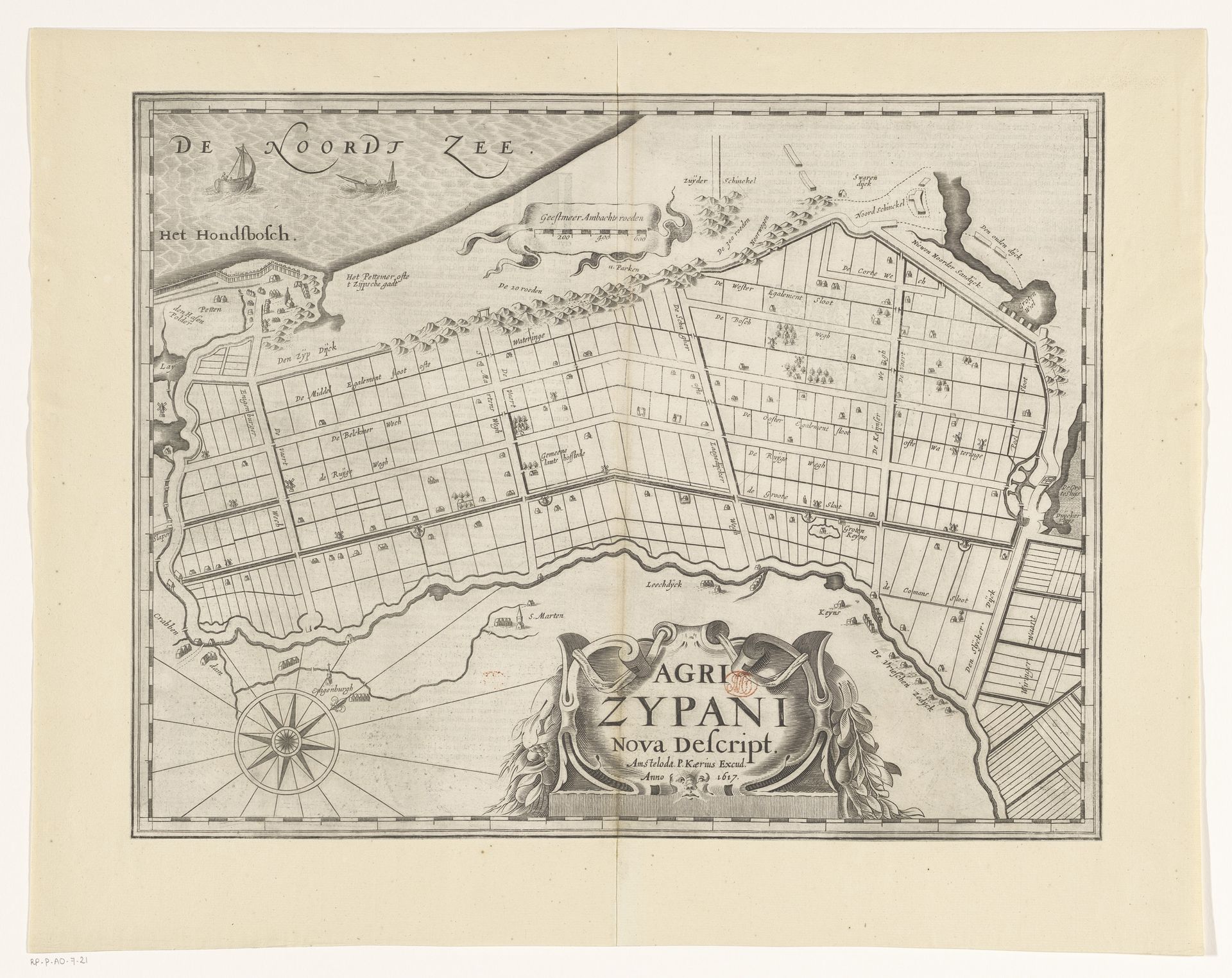
1617 - 1622
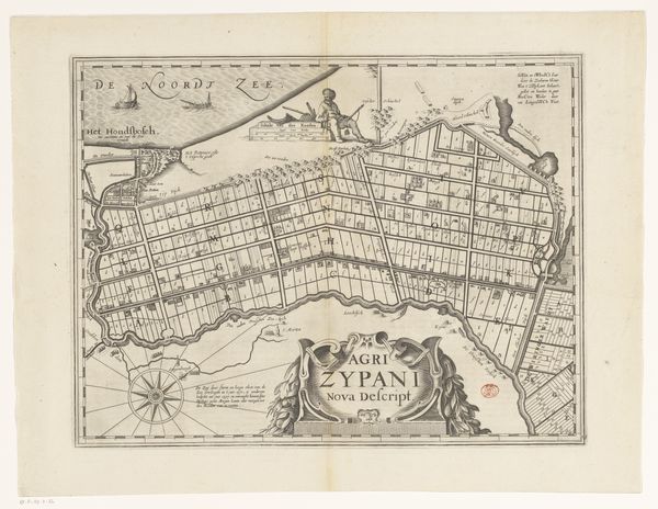
Kaart van de Zijpe- en Hazepolder
Pieter van der Keere
1571 - 1646Location
RijksmuseumListen to curator's interpretation
Curatorial notes
This is Pieter van der Keere’s map of the Zijpe- and Hazepolder, made sometime between 1598 and 1646. It’s an etching, meaning that the image was incised into a metal plate with acid, before being inked and printed onto paper. The map represents a landscape entirely shaped by human effort. The Zijpepolder is a polder, or reclaimed land, in North Holland. What's fascinating is how the practical need to record and manage this new territory becomes an aesthetic project. Look at the crisp lines defining each parcel of land, the detailed rendering of waterways and settlements. Maps like these were not just documents; they were tools for control and instruments of power. They reflect a society intent on reshaping the natural world to its will. This polder represents an impressive feat of engineering, and a testament to human intervention in the landscape, turning water into land, and nature into a grid. The very act of mapping is an imposition of order, transforming a complex reality into a legible format. So, we can appreciate this map not only for its geographical accuracy, but as a potent symbol of human ambition and the drive to master our environment.