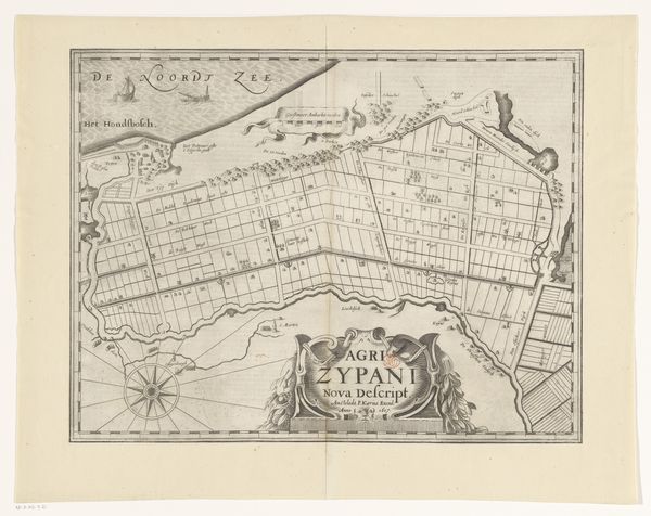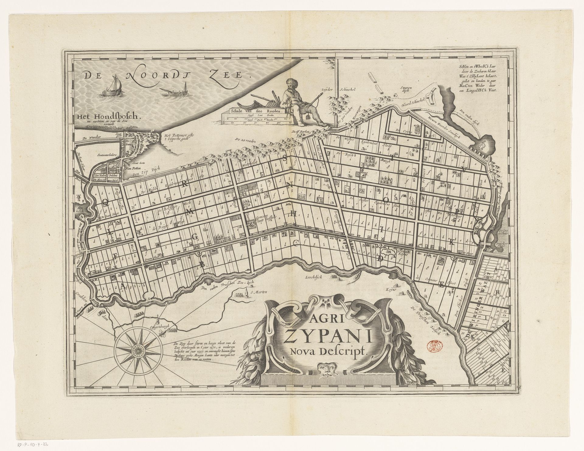
1617 - 1662
Kaart van de Zijpe- en Hazepolder
Pieter van der Keere
1571 - 1646Location
RijksmuseumListen to curator's interpretation
Curatorial notes
Curator: Take a moment to study this engraving from sometime between 1617 and 1662: a "Kaart van de Zijpe- en Hazepolder," or map of the Zijpe and Hazepolder. The printmaker was Pieter van der Keere. Editor: I’m immediately struck by the ordered quality of this landscape! From above, the waterways form sharp divisions across the territory. But look closer and one will note all sorts of small symbols and marks! Like an architect's initial vision of their grand construction—linear, practical, and strangely… fragile. Curator: The technique of engraving means a lot of planning. The marks are deliberate, reflecting a carefully organized agricultural region made from drained wetlands. We're witnessing not just land, but a landscape manufactured through enormous physical and organizational labor. Think of the tools and processes involved. Editor: Exactly! A landscape born from sheer force of will! The neat parcels, the imposed grids. Yet, as a drawing, it feels almost playful to me—a miniature world. The artist must have climbed up the tallest point of the Zijpe- en Hazepolder to feel at home, but one also needs to appreciate the physical exertion and social infrastructure of their enterprise. Curator: This piece shows not only artistry, but a complex engagement with territory and authority—a tangible way the Dutch Republic organized itself. The map served functional and symbolic purposes, and, in a sense, justified control of this region. What is most important to retain, then, is the labor that made it feasible. Editor: So very true! Perhaps we need to approach these old treasures not as curiosities but blueprints from people once as vigorous, flawed, hopeful, and ruthless as us. What does the map whisper about lost languages? What forgotten feelings might the picture restore to consciousness? Curator: Looking at this work and the way it presents information offers new appreciation for historical shifts in both visual communication and landscape manipulation. Editor: I agree—thanks for shining a light on this one! The map now inspires some very poignant reflections!