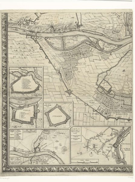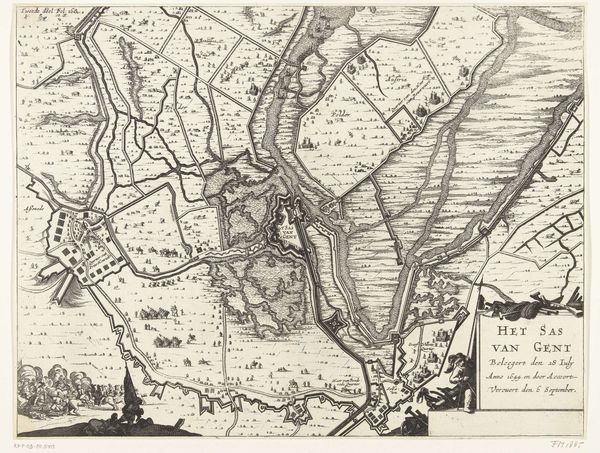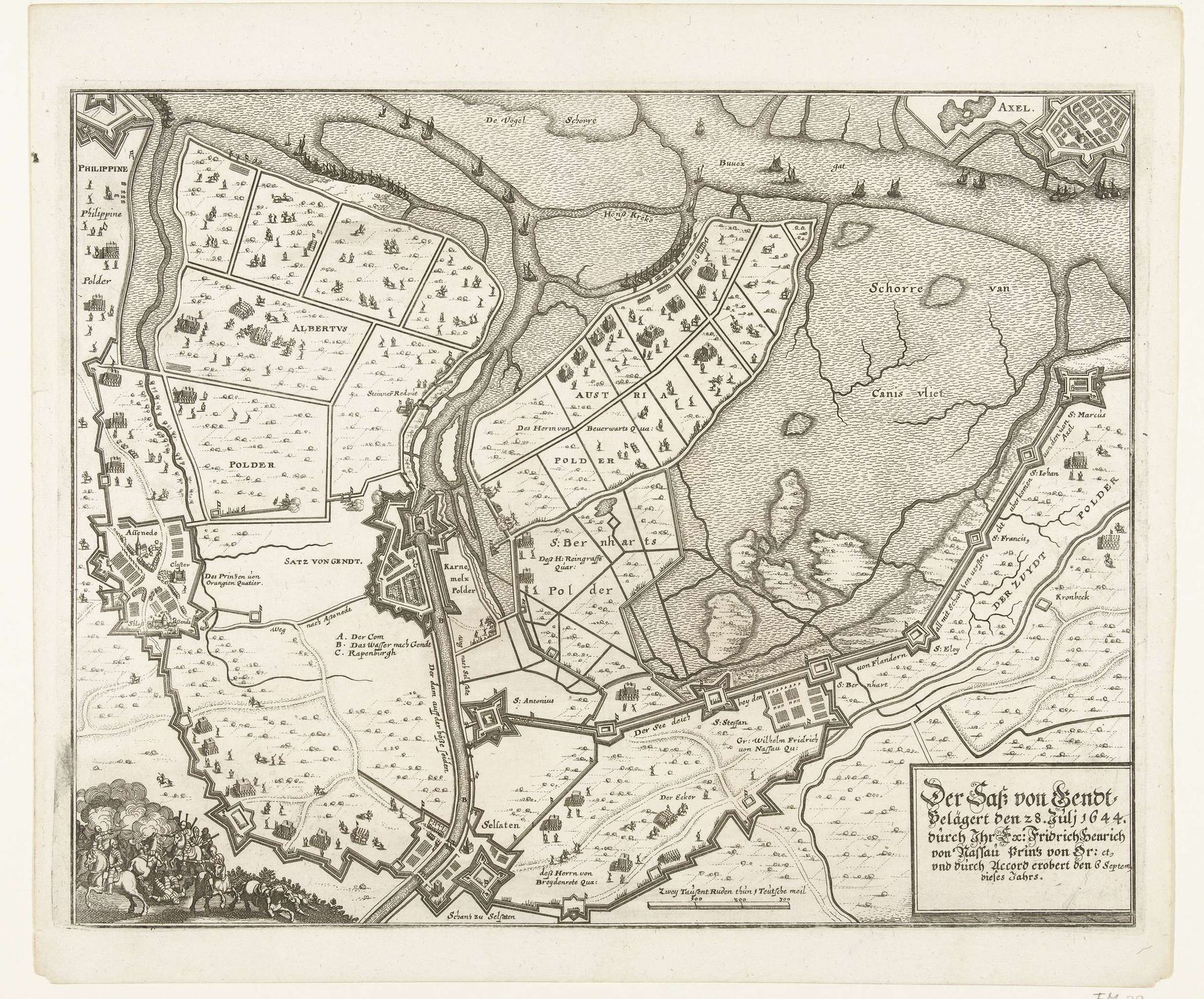
1644
Kaart van beleg en verovering van Sas-van-Gent, 1644
Anonymous
@anonymousLocation
RijksmuseumListen to curator's interpretation
Curatorial notes
This is an anonymous print from 1644, titled "Map of the siege and conquest of Sas-van-Gent." Created during the Dutch Republic's Eighty Years' War, this map encapsulates a pivotal moment of territorial struggle. It depicts the siege of Sas-van-Gent by the Dutch forces led by Frederick Henry, Prince of Orange. The image is more than just a geographical document; it's a narrative of power, identity, and conflict. The map intricately details the military strategies and fortifications, but also subtly reveals the human impact of war on the landscape and its inhabitants. These meticulously drawn fields and waterways once represented life and sustenance. Now they are grounds for conflict and potential loss. It represents the emotional and personal dimensions of war - it is the charting of lost homes, of divided loyalties, and disrupted lives. This map serves as a poignant reminder of how cartography can reflect not just physical spaces, but also the complex interplay of power, identity, and human experience in times of conflict.