drawing, watercolor
#
drawing
#
landscape
#
watercolor
#
watercolor
Dimensions: height 281 mm, width 385 mm
Copyright: Rijks Museum: Open Domain
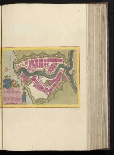
Pieter Husson made this map of Badajoz with pen and ink and watercolour. It shows the city situated on the Guadiana river with a geometric formality. Note the star-shaped fort on the riverbank, and the concentric structure of the city walls. Maps like this were not just geographical tools but also instruments of power. Made in the Netherlands, this map reflects a time of shifting European allegiances and military campaigns. Badajoz, a Spanish city near the Portuguese border, held strategic importance, leading to many sieges and battles over the centuries. This map provides insight into 18th-century military strategy, where the ability to represent and read terrain was crucial. Its creation reflects the increasing professionalization of both map-making and military expertise, driven by the needs of statecraft. By consulting period documents, military records, and other cartographic sources, historians can reconstruct the social and political contexts that shaped the map.
Comments
No comments
Be the first to comment and join the conversation on the ultimate creative platform.
More like this