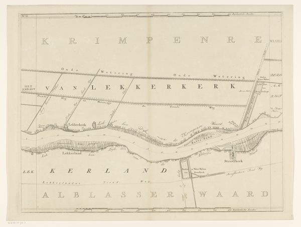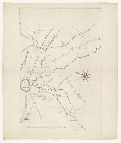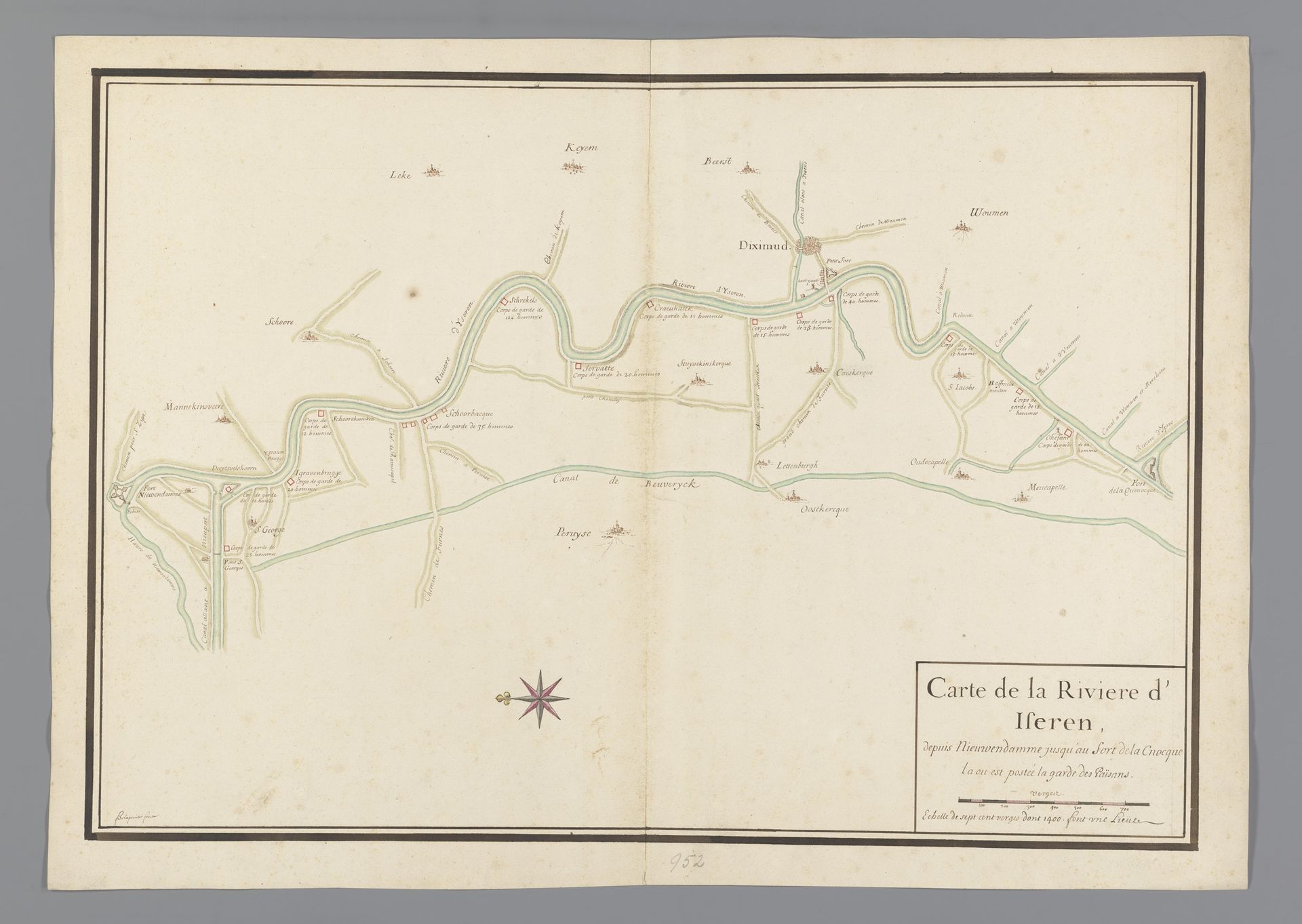
1667 - 1690
Kaart van rivier de IJzer
François de La Pointe
@francoisdelapointeLocation
RijksmuseumListen to curator's interpretation
Curatorial notes
Curator: Welcome. Here at the Rijksmuseum, we have before us a work entitled "Kaart van rivier de IJzer," dating approximately between 1667 and 1690, created by François de La Pointe. This drawing on paper, made with ink, details a landscape focusing on the River IJzer. Editor: Immediately, I’m struck by the muted tones and delicate lines; it conveys a quiet, almost melancholic feel. It's very precise, yet feels vast in its scope. Curator: Indeed. Cartography in this era served not just geographical purposes but had immense socio-political weight. Mapping a river like the IJzer provided strategic advantages for military planning and trade routes control. It solidified territorial claims and the exercise of power over the landscape. Editor: Absolutely. The act of mapping is an assertion of dominance. Who had the power to define this space, who got to name the settlements? Looking at it through a postcolonial lens, it raises questions about whose narratives are prioritized and whose are erased. Also, thinking about the ecological implications; controlling the river shapes lives and economies. Curator: Precisely. We see the built environment interspersed along its path – settlements, likely fortified points. Understanding their locations in relation to the river becomes key to understanding patterns of power. These towns would become reliant on this source for food and transportation. Editor: The decorative elements too, are loaded with symbolic potential; the compass rose, for example. It is a reminder of global interconnectedness. Even in detailing a singular river, it implicates broader colonial structures of exploration and extraction. And while there is so much careful observation here, I’m curious about the subjective lens through which this space has been interpreted. Curator: The accuracy and detail were tools of the powerful; by mapping the territory they exercised increasing administrative control, which could often lead to cultural and environmental exploitation. It served an important role for consolidating state power in this period of European expansion. Editor: Viewing this map not simply as a depiction, but also as an agent— a participant in its time—really complicates my understanding of its legacy. It becomes so much more than ink on paper; it’s enmeshed within those complicated dynamics of power. Curator: And I think reflecting on how a seemingly neutral depiction carries profound implications allows us a broader context in this present moment. Editor: It makes me think critically about the legacy of such instruments, the ways cartography has been weaponized in various socio-political conflicts.