drawing, paper, ink
#
drawing
#
landscape
#
paper
#
ink
#
geometric
#
history-painting
Dimensions: height 234 mm, width 360 mm
Copyright: Rijks Museum: Open Domain
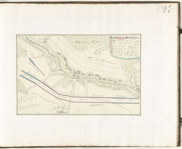
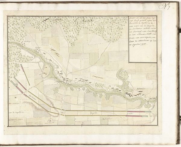
Samuel Du Ry de Champdoré created this drawing of the Allied army camp at Sint-Pietersberg in 1705. The composition is organized around a high vantage point which flattens the landscape into a series of zones. The schematic arrangement depicts a military strategy by use of spatial organization. The use of color, though muted, is strategic, demarcating different regiments and areas of fortification. This encoding enables the viewer to navigate and understand the deployment of forces, reducing the complexities of military planning into legible signs. The structured arrangement mirrors the Enlightenment's emphasis on rational order. Champdoré’s plan challenges fixed meanings, rendering a dynamic military landscape into a static, analyzable form. The map doesn't just represent space, it interprets and reorganizes it. The artwork anticipates modern mapping techniques, transforming physical space into abstract data that speaks volumes about power, control, and the gaze of authority.
Comments
No comments
Be the first to comment and join the conversation on the ultimate creative platform.
More like this