1737 - 1765
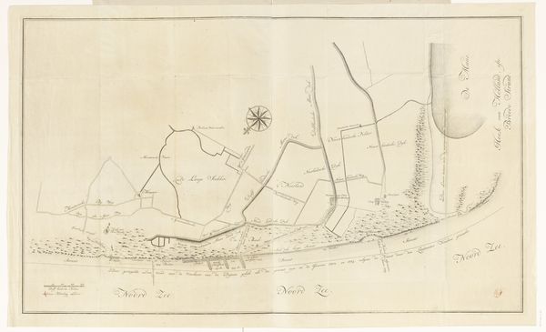
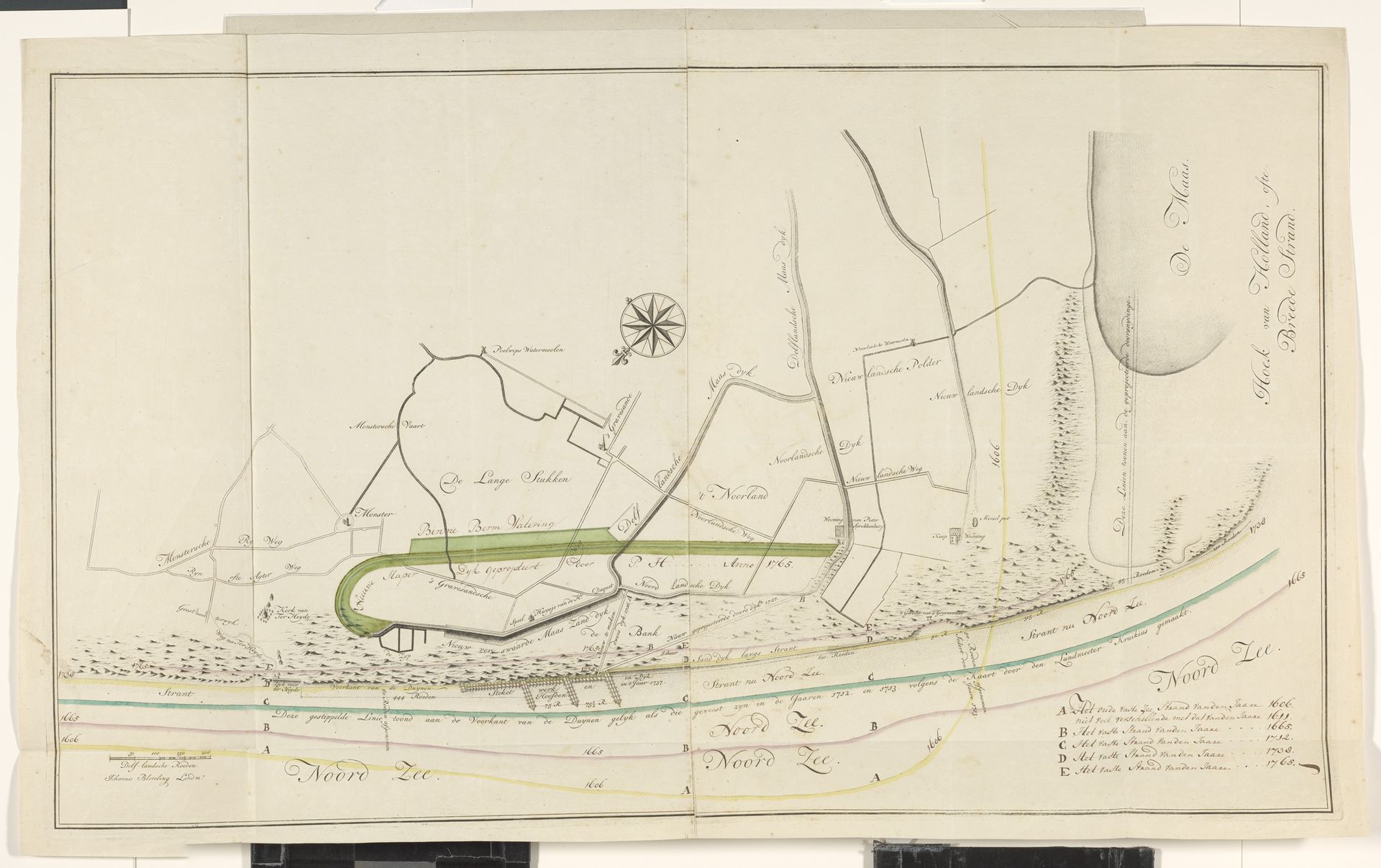
Kaart van het kustgebied tussen Monster en Hoek van Holland
Listen to curator's interpretation
Curatorial notes
This map of the coastal area between Monster and Hook of Holland was created by an anonymous author, using pen and watercolor. Cartography was a pursuit of both state and commercial interests in the Netherlands. Accurate maps were tools to facilitate trade and settlement. At the same time, they were instruments of military power, critical for defense of the low-lying country against both human and natural threats. Note the detailed attention to dikes in this image. The cultural significance of this map lies in its dual role. On the one hand, it embodies the Dutch Republic's scientific and economic ambitions. On the other, it underscores the constant struggle to control and manage the landscape, a struggle that has profoundly shaped Dutch identity. Further research into the archives of the Dutch water boards would provide a richer understanding of the relationship between Dutch artistic traditions and institutional history.