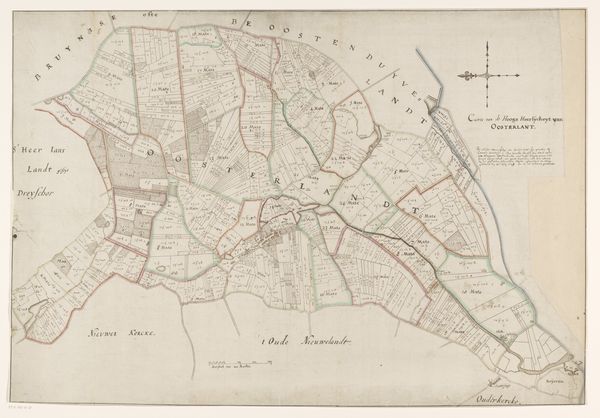
print, etching, engraving
#
dutch-golden-age
# print
#
etching
#
landscape
#
etching
#
romanticism
#
genre-painting
#
engraving
#
realism
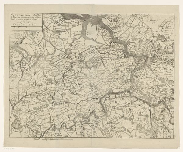
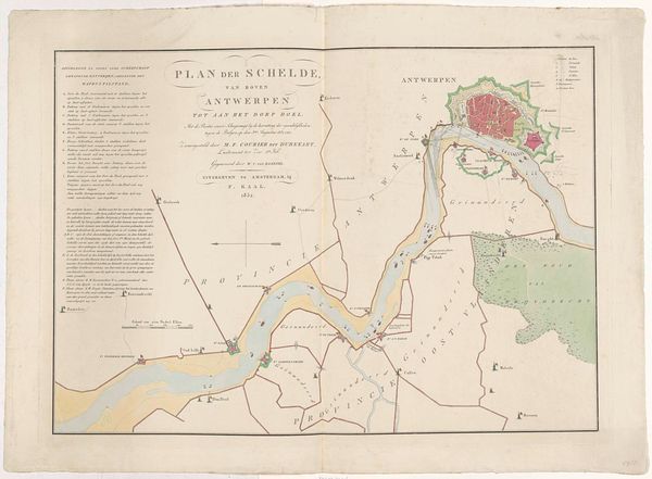
Dimensions: height 580 mm, width 370 mm
Copyright: Rijks Museum: Open Domain
Editor: This is "Kaart van de Schelde, 1832" by Alexander Oltmans, a print, combining etching and engraving. It's essentially a detailed map of the Scheldt river. The detail is quite striking, but I’m curious about the context around its creation. What can you tell me about the significance of this map beyond its function as a navigational tool? Curator: Well, maps like this weren't just about getting from point A to point B. Consider the moment in 1832; just two years before Belgium formally gained its independence from the Netherlands. This map visualizes territory, a tool in defining and asserting national identity. It tells a story of power and control. Notice how clearly Antwerp, a vital port city, is rendered. Who do you think was the intended audience for such a detailed and beautiful map? Editor: Perhaps merchants or political figures? Those with a vested interest in trade and governance of the region? Curator: Exactly! This wasn’t cartography for the common person; it was about visualizing the economic and strategic importance of the Scheldt river, especially in light of shifting political boundaries. Look at the precision used. The map becomes an argument, an assertion of the importance of this waterway. How might this map have been used to promote national interests? Editor: It could showcase the region's resources and infrastructure, attracting investment and solidifying claims to the territory by visualizing control and knowledge of the land. Curator: Precisely! It turns geography into a political statement. Now, does knowing this context change how you view this seemingly simple map? Editor: Absolutely. It's no longer just a depiction of the river, it’s a snapshot of a pivotal moment in history, revealing power dynamics and the strategic importance of geography. Curator: It is a reminder that even the most seemingly objective images can be deeply entwined with political and social agendas. It challenges us to look deeper. Editor: This has given me a lot to think about!
Comments
No comments
Be the first to comment and join the conversation on the ultimate creative platform.
More like this