drawing, print, paper, ink, engraving
#
drawing
#
baroque
# print
#
paper
#
ink
#
geometric
#
cityscape
#
history-painting
#
engraving
Dimensions: height 286 mm, width 337 mm
Copyright: Rijks Museum: Open Domain
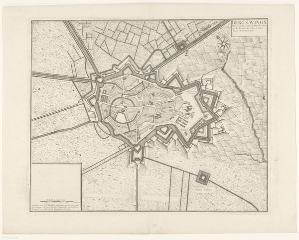
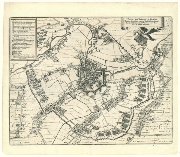
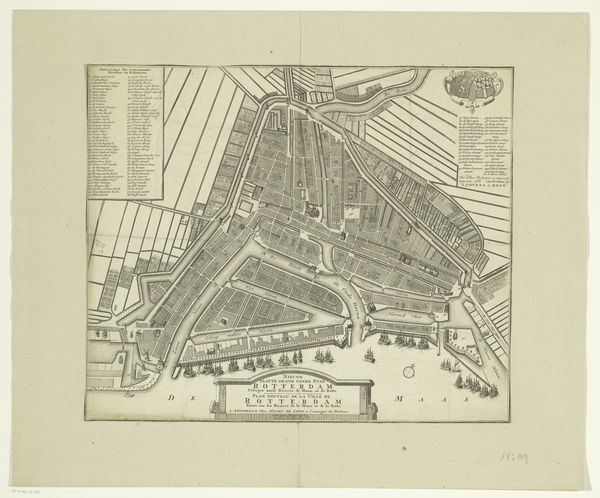
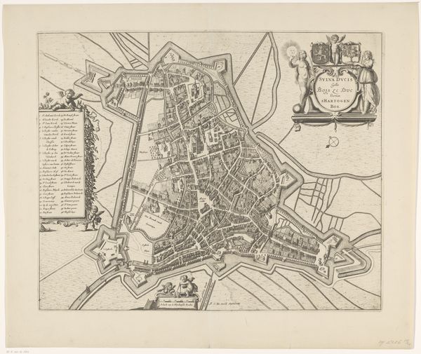
This is B.F. Immink's "Plattegrond van Breda," an undated drawing rendered with fine lines. The drawing presents a detailed bird's-eye view of the city, immediately revealing an intricate system of fortifications that encircle it. These geometric shapes, rendered with precision, dominate the visual field. The composition draws the eye from the detailed fortifications to the more organic layout of the city within. Streets and buildings are delineated with a controlled hand, suggesting a harmonious relationship between human construction and strategic defense. The map is a network of signs that operate on multiple levels. Functioning as a practical tool for navigation and urban planning, it is also a representation of power. The city's fortifications and structured design, underscore themes of control, order and the imposition of human will. The "Plattegrond van Breda" exemplifies how a seemingly straightforward representation of space embodies complex ideas about power, knowledge, and the human relationship to the environment.
Comments
No comments
Be the first to comment and join the conversation on the ultimate creative platform.
More like this