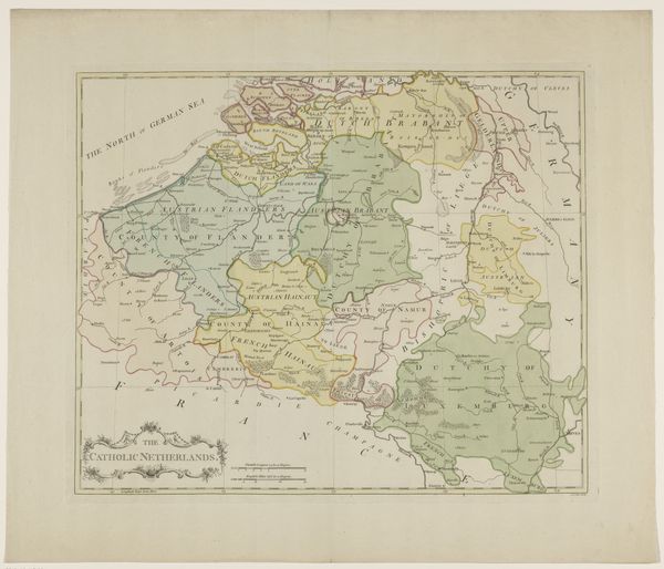
print, engraving
aged paper
dutch-golden-age
landscape
linocut print
engraving
Dimensions: height 351 mm, width 468 mm
Copyright: Rijks Museum: Open Domain
Curator: Looking at this print, I’m immediately struck by the density of detail – it feels like a landscape woven with a million tiny threads. Editor: That’s a beautiful observation. What we’re looking at is "Kaart van de hertogdommen Brabant, Gulik en Kleef," a map created in 1628 by Gerardus Mercator. As you can see, it's an engraving, so your impression of 'woven threads' is especially apt. Curator: An engraving from the Dutch Golden Age! How did Mercator approach this territory politically, or socially, during the complexities of his time? Editor: As an iconographer, my first inclination is toward the rivers and waterways rendered almost like veins. This speaks volumes about trade routes and interconnectedness during a time of immense social and political change. Rivers meant power and accessibility. The symbolic emphasis on them underlines their real value. Curator: Yes, I think viewing maps is especially salient now. This engraving visually constructs a specific geography, suggesting ownership and control – claims made manifest on paper. What does the detail, or lack thereof, tell us about who and what was prioritized? And who was deliberately omitted, if anyone? Editor: A valid point. Mercator's projection distorts as it expands northward, favoring certain latitudes at the expense of others. It begs the question, how do cartographical choices inadvertently reinforce political power and cultural assumptions? I would love to delve further into how place names carry specific cultural weights, shaping identities and narratives tied to these regions. They are, after all, visual symbols on the cultural psyche, emblems, in other words. Curator: Absolutely, by examining Mercator’s work through our own contemporary lenses, we start to unveil how maps like this became powerful tools. A means for shaping geopolitical perspectives and cementing narratives of cultural dominance and regional definition. Editor: True, viewing it from an iconographic perspective reminds us of their enduring cultural legacy. These are not simply maps; they are repositories of layered symbolism that shape and perpetuate stories across generations. Curator: Seeing it with those stories etched in reminds me that we must look critically at the assumed neutrality of these historical artifacts. Editor: Indeed. And this one’s invitation to re-imagine these ancient territories and the values placed on its regions might prompt reflection and possibly, trigger our audiences own identity.
Comments
No comments
Be the first to comment and join the conversation on the ultimate creative platform.