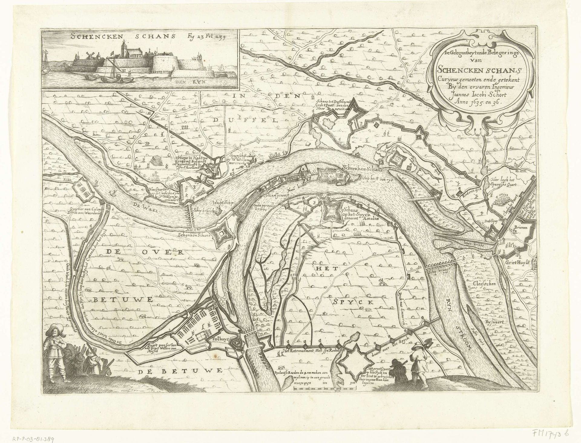
1651 - 1652
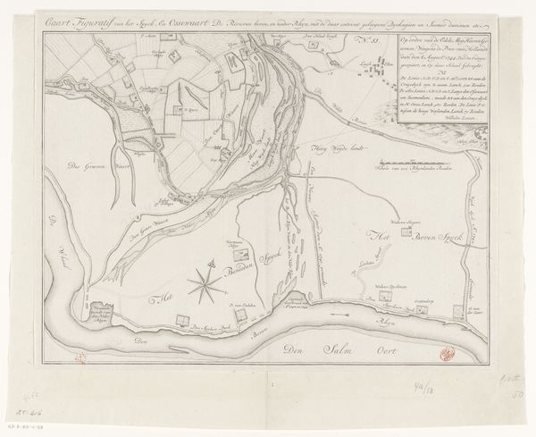
Kaart met beleg en verovering van Schenckenschans door Frederik Hendrik, 1635-1636
Anonymous
@anonymousLocation
RijksmuseumListen to curator's interpretation
Curatorial notes
This anonymous map depicts the siege and conquest of Schenkenschans by Frederik Hendrik, likely made shortly after the event between 1635 and 1636. The detailed etching provides insight into the military strategies and territorial disputes of the period. Maps were not merely tools for navigation; they were powerful expressions of dominance and control. Here, the representation of Schenkenschans, a strategically important fortress, underscores the complex relationship between military power and geographical space during the Dutch Revolt. Consider how the act of mapping itself could function as a form of conquest, visually asserting ownership and authority over contested lands. What stories aren't being told through this supposedly objective depiction? How does the map’s focus on military strategy obscure the experiences of the people living in and around Schenkenschans? Whose perspectives are privileged, and whose are silenced? The map invites us to reflect on the subjective nature of history and the power dynamics embedded in its representation.