print, engraving
#
baroque
#
dutch-golden-age
# print
#
landscape
#
history-painting
#
engraving
Dimensions: height 159 mm, width 190 mm
Copyright: Rijks Museum: Open Domain
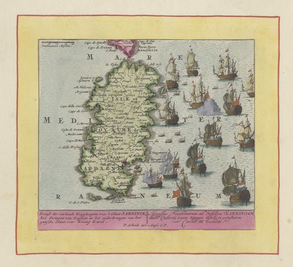
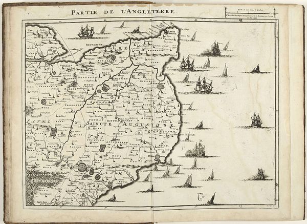
This is Pieter Schenk’s map of Alicante, printed around 1700. Dominating the composition are the ships at sea, symbols of power, trade, and conflict. These vessels are not merely navigational tools, but potent emblems of human ambition and reach. Consider how similar maritime motifs recur across different cultures, from ancient Greek pottery depicting naval battles to Viking longboats carved into runestones. These ships echo through the ages, each iteration carrying forward a collective memory of seafaring adventures, carrying goods and people to new shores. Yet, their significance evolves. In earlier times, they might represent exploration and discovery. Here, they seem poised for military action. Such a shift reflects changing societal preoccupations and anxieties. Perhaps, unconsciously, we are drawn to such imagery because it stirs deep-seated feelings of curiosity, risk, and the ever-present potential for both triumph and disaster. The map becomes a stage for the cyclical drama of human experience, where symbols are constantly reborn.
Comments
No comments
Be the first to comment and join the conversation on the ultimate creative platform.
More like this