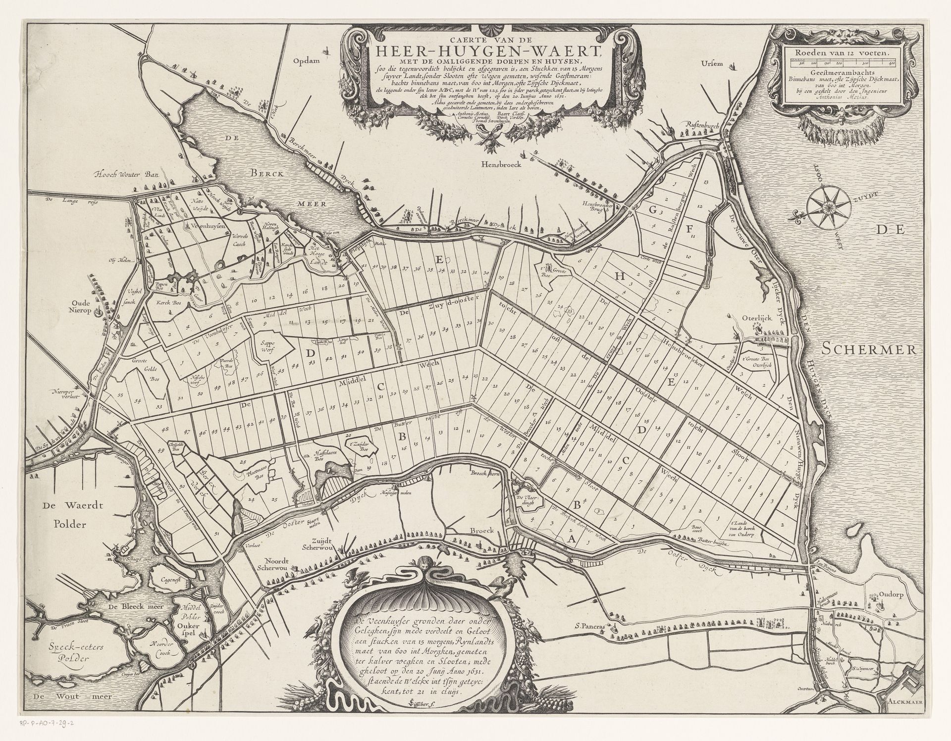
before 1825
Kaart van de verlote kavels in de Heerhugowaard, 1631
Anonymous
@anonymousLocation
RijksmuseumListen to curator's interpretation
Curatorial notes
This is an anonymous map of the Heerhugowaard polder, dating from 1631. It is an intricate drawing with precise lines which define the plots of land. At first glance, one is struck by its geometric structure. The neat grid-like composition, segmented into individual parcels, suggests a carefully planned and rationally organized space. But this sense of order is somewhat deceptive. The map is not simply a neutral record but a representation of a highly structured, human-imposed division of nature. Consider how this meticulous partitioning reflects the values of the time: a desire to control and manage the land. It also reflects a semiotic system, where each parcel can be seen as a sign, with meanings and values, encoded by the authorities and landowners. The map challenges fixed meanings and provides new ways of thinking about space. Look again at the lines and the way they carve up the landscape. These are not just lines, but rather a visual manifestation of power, property, and human intervention in the natural world. The map invites us to consider the complex interplay between representation, authority, and the landscape itself.