print, paper, engraving
#
dutch-golden-age
# print
#
pen illustration
#
old engraving style
#
landscape
#
paper
#
engraving
Dimensions: height 689 mm, width 398 mm
Copyright: Rijks Museum: Open Domain
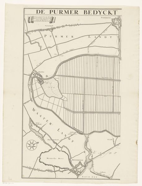
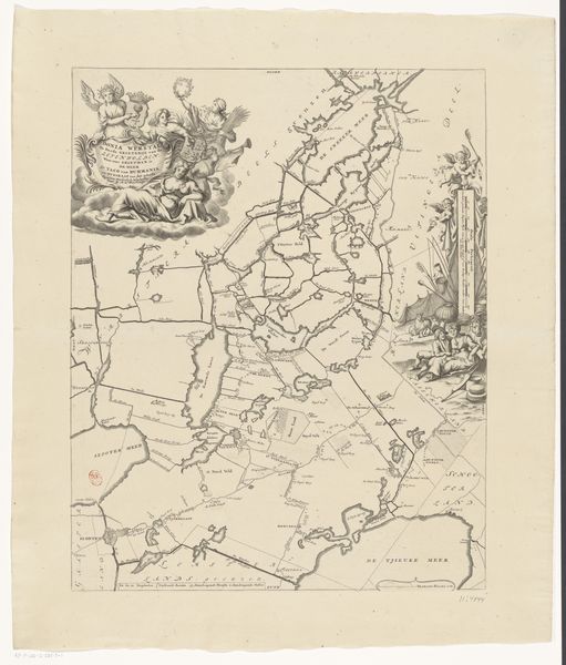
This detailed map segment, titled 'Kaart van de Purmer', offers a glimpse into the engineered landscape of 17th-century Netherlands. Though its creator remains anonymous, the map speaks volumes about the relationship between the Dutch and their environment. During this period, land reclamation was not just an engineering feat, but a cultural endeavor, shaping Dutch identity. The rigid lines dividing the land suggest control and order, a testament to human intervention. These lines represent polders, areas of land reclaimed from water, which reflect a society intent on mastering nature. Consider the emotional weight of this landscape for those who lived and worked there. The draining and dividing of land displaced communities, altering traditional ways of life. This map is not just a record of land, but a silent witness to societal transformation, mirroring both progress and loss. It invites us to reflect on the enduring impact of human actions on the environment and its inhabitants.
Comments
No comments
Be the first to comment and join the conversation on the ultimate creative platform.
More like this