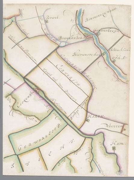
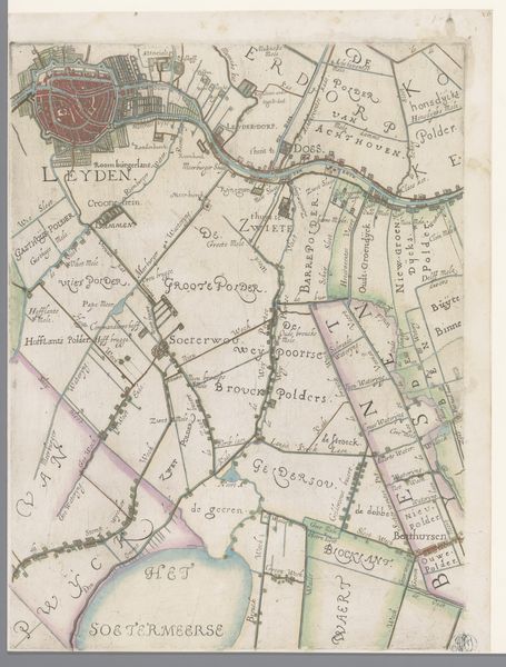
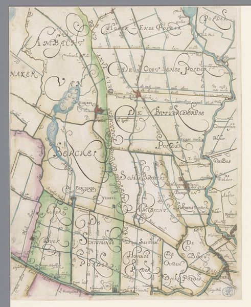
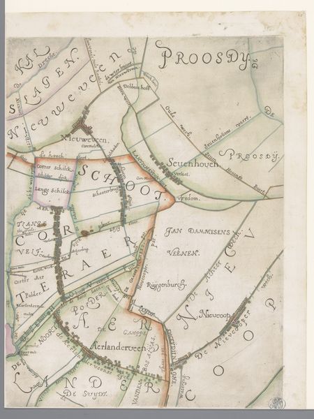
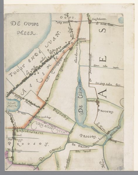
Deel van een kaart van het Hoogheemraadschap van Rijnland, met Noorden en omgeving 1615
0:00
0:00
florisbalthasarszvanberckenrode
Rijksmuseum
drawing, etching, paper, ink
#
architectural sketch
#
drawing
#
dutch-golden-age
#
etching
#
landscape
#
etching
#
paper
#
ink
#
geometric
#
architectural drawing
#
architecture drawing
Dimensions: height 371 mm, width 284 mm
Copyright: Rijks Museum: Open Domain
Curator: Oh, this whispers tales of bygone days! Looking at it now, this fragment seems like a memory half-remembered, wouldn’t you say? I feel a soft sort of wonder gazing at it. Editor: It's fascinating to consider how maps can tell us so much more than just geographical data. Here we have "Deel van een kaart van het Hoogheemraadschap van Rijnland, met Noorden en omgeving," which translates to "Part of a map of the High Water Board of Rijnland, with Noorden and surroundings." It was drawn in 1615 by Floris Balthasarsz van Berckenrode and made using etching, ink, and paper. It's a geographical, and, of course, a political document. Curator: A political document! Oh, absolutely! It feels almost subversive in a quiet way, like it holds secret strategies tucked into the neat little lines, don’t you think? Seeing all these defined boundaries gives off this feeling of power—almost tangible on the page! Editor: Right! This wasn't just about showing where things were; it was about claiming authority over the land. Rijnland was—and is—a region constantly battling the threat of water. A detailed map like this would be crucial for water management, taxation, and even military planning. And look how clearly the waterways are etched. Curator: Yes, almost alive—those watercourses have a fluidity to them! Imagine tracing them with your fingertips, the ink cool beneath your hand. In a way, aren’t we all trying to map out our lives, draw our own boundaries? Editor: Indeed. And notice how the typography varies; the lettering conveys a hierarchy of settlements and areas of jurisdiction, all carefully planned to assert the dominance of Rijnland's administrative power during a period when the Dutch Republic was asserting its own identity and sovereignty. Maps like these served to impress upon people both local and foreign, the scope and mastery the Dutch had over their territory. Curator: Like claiming a narrative! A story written with lines and ink. Doesn't it give you a yearning for that time? The precision… but also, that beautiful handmade quality. Editor: Exactly, but, let's also not forget how cartography participated in some of the power dynamics of that time, in an early form of surveillance or data collection, even. But there is something deeply captivating, perhaps especially now in our digital age, about such hand-crafted documents. Curator: Perhaps that's what captivates me... in our age of the pixel, something drawn by human hands feels nothing short of magical. Editor: So true. Thinking about it this way adds layers to appreciating not just the craft but its historical relevance.
Comments
No comments
Be the first to comment and join the conversation on the ultimate creative platform.
More like this