drawing, print, paper, ink, engraving
#
drawing
#
baroque
# print
#
landscape
#
paper
#
ink
#
cityscape
#
history-painting
#
engraving
Dimensions: height 338 mm, width 490 mm
Copyright: Rijks Museum: Open Domain
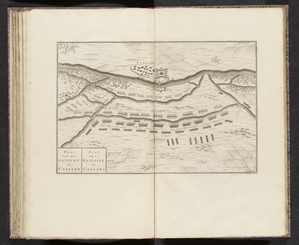
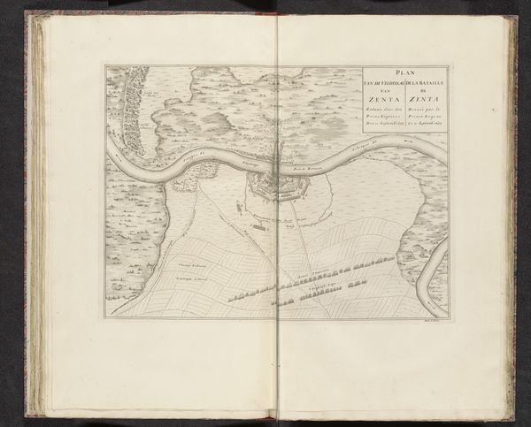
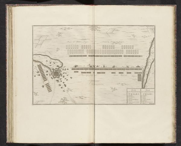
This is an anonymous map of the Battle of Luzzara, created in 1702. It is dominated by a meticulous arrangement of shapes and lines. Two opposing armies face each other across a field, rendered as neat rows of rectangles. This ordered composition belies the chaos of battle. The linear precision of the map contrasts with the terrain, which is sparsely indicated by sketched hills and a winding river. Luzzara itself is represented as a walled enclosure, and the arrangement of troops suggests a chess board where strategic positioning determines the outcome. The map's aesthetic engages with the conventions of cartography and military science, where clarity and precision are paramount. It attempts to impose a rational order on a complex and unpredictable event. This reflects a broader cultural desire to understand and control the world through rational means. By decoding the map's semiotic system, we can gain a deeper appreciation of the historical context and the mindset of its creators.
Comments
No comments
Be the first to comment and join the conversation on the ultimate creative platform.
More like this