drawing, print, paper, ink
#
drawing
# print
#
landscape
#
paper
#
ink
#
coloured pencil
#
geometric
#
history-painting
Dimensions: height 368 mm, width 480 mm
Copyright: Rijks Museum: Open Domain
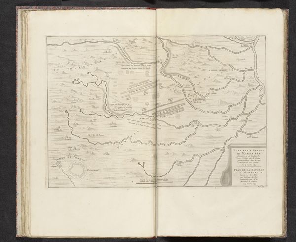
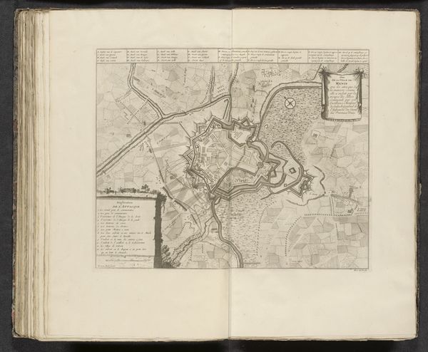
This is an anonymous map from 1697, depicting the Battle of Zenta, it is rendered with ink on paper. Notice how the composition divides the scene into distinct zones: the detailed river landscape curves across the upper half, contrasting with the geometric precision of the fields and military formations below. The linear quality of the engraving emphasizes structure, highlighting the strategic arrangement of space and forces. The cartographer used line and form to create a semiotic system that communicates military positioning and geographical features. This map invites us to consider how representations of space are inherently constructed, reflecting power dynamics. The formal precision and ordered layout of the map is not just an aesthetic choice, but a deliberate encoding of control and knowledge.
Comments
No comments
Be the first to comment and join the conversation on the ultimate creative platform.
More like this