drawing, print, paper, ink, engraving
#
drawing
#
aged paper
#
toned paper
#
baroque
# print
#
landscape
#
paper
#
personal sketchbook
#
ink
#
ink drawing experimentation
#
geometric
#
pen-ink sketch
#
pen and pencil
#
pen work
#
sketchbook drawing
#
storyboard and sketchbook work
#
sketchbook art
#
engraving
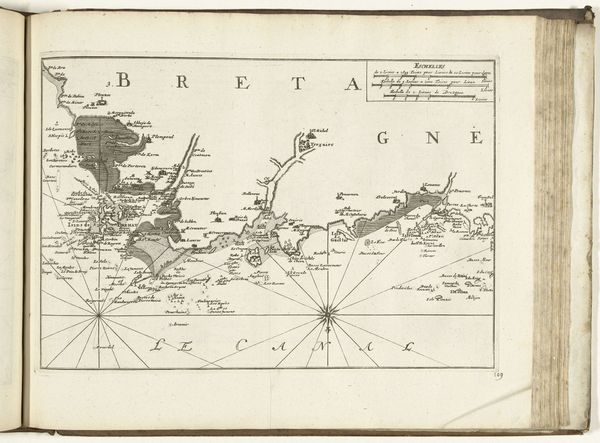
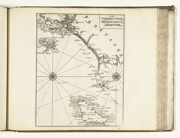
Dimensions: height 228 mm, width 334 mm
Copyright: Rijks Museum: Open Domain
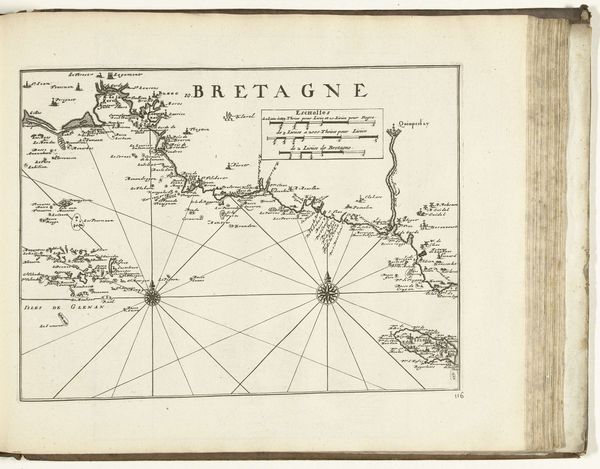
This is an anonymous map of the west coast of Bretagne near Brest, created in 1726. Maps are more than just navigational tools; they are cultural artifacts that reflect the values, knowledge, and power structures of their time. Consider what it meant to map a territory during the age of exploration and colonialism. These maps were instrumental in laying claim to new lands, influencing trade routes, and asserting dominance over indigenous populations. It is a story of how Europeans saw the world and their place in it. This particular map is one of countless images and documents from the period that served to literally draw the boundaries of nations, but they were also drawing lines between the included and the excluded, the known and the unknown. This map embodies a moment in time when cartography and culture were deeply intertwined.
Comments
No comments
Be the first to comment and join the conversation on the ultimate creative platform.
More like this