c. 1685
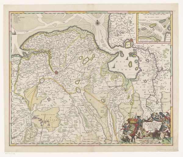
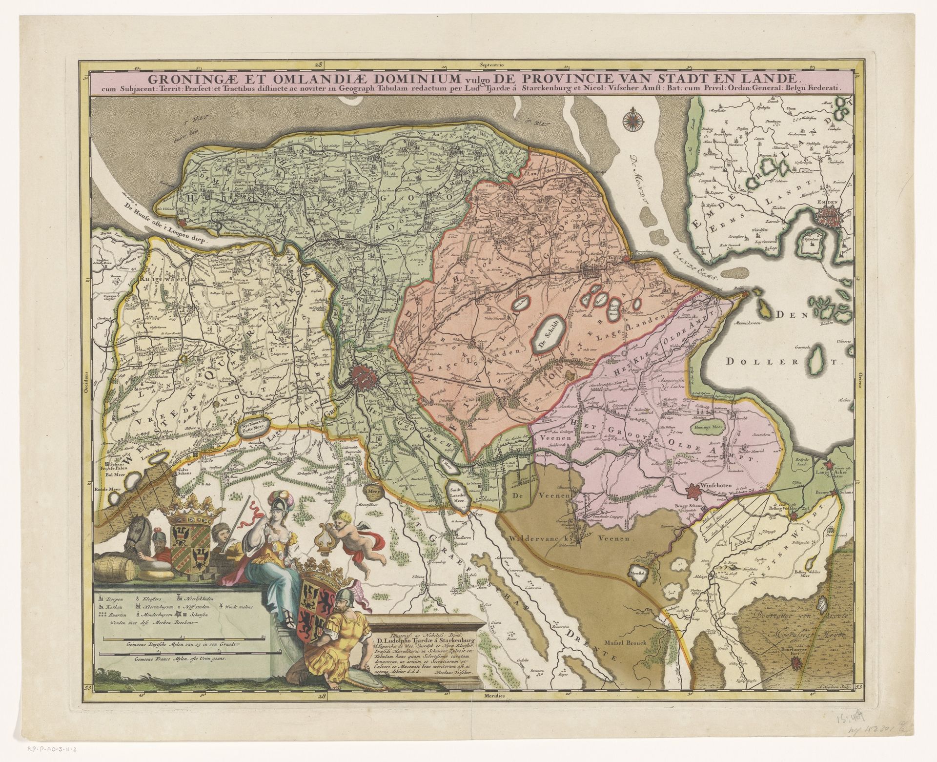
Kaart van de provincie Groningen
Listen to curator's interpretation
Curatorial notes
Andries Hogeboom created this old map of the province of Groningen. Its creation reflects a time when cartography was as much about asserting power and identity as it was about geographical accuracy. Notice how the map meticulously details the region's landscape, but also includes symbolic elements like the coat of arms and allegorical figures. These additions served to legitimize the province's authority and reinforce its cultural identity. In the 17th and 18th centuries, maps were tools of governance and instruments of cultural expression, deeply intertwined with the socio-political context of the time. Consider the emotional weight of this map for those who lived in Groningen. It not only represented their physical surroundings, but also their sense of belonging and their place in the world. Maps like these were not neutral documents; they shaped perceptions and solidified identities. They told a story about who belonged and who held power.