About this artwork
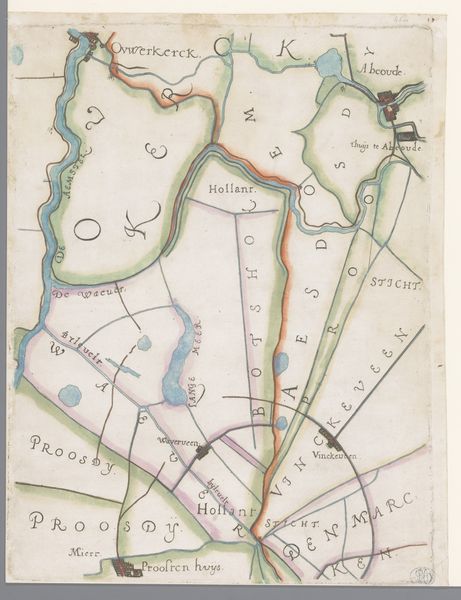
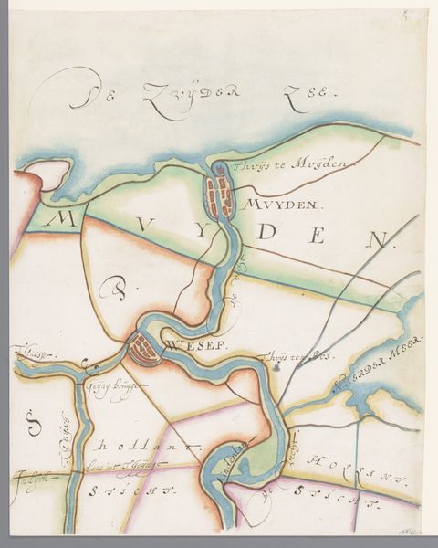
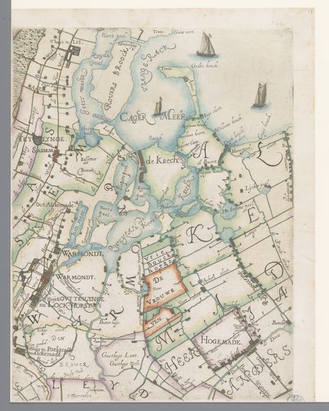
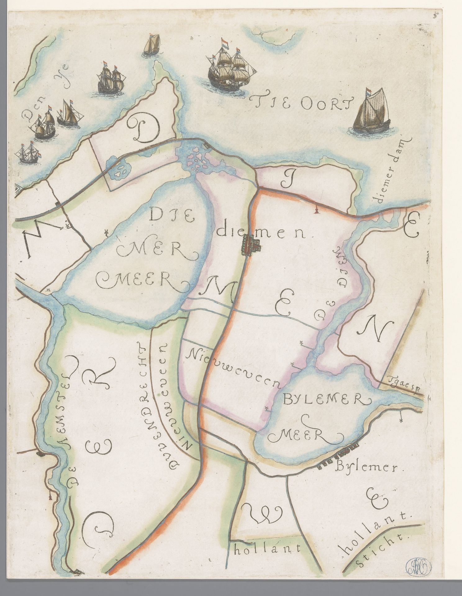
This is a section of a map of the Rijnland region with Diemen, created by Floris Balthasarsz van Berckenrode. The delicate watercolor and ink lines describe not just geographical space, but also the conceptual divisions of land and water. Observe how color is used less for realistic depiction and more for categorization, a kind of visual language. The light blues denote waterways, while landmasses are articulated with soft greens and yellows. The composition isn't just about spatial arrangement; it's about defining relationships, structuring territories through line and color. The cartographer uses a semiotic system, where each symbol — a ship, a building, or a letter — functions as a sign, encoding layers of meaning. The scale and placement of these elements contribute to a broader narrative, reflecting the social and economic values attached to the land. Consider how this map destabilizes our understanding of space. It is not a passive representation but an active construction, shaping perceptions and asserting control. Its lasting impact resides in its ability to invite ongoing interpretation, not as a fixed historical document, but as a dynamic cultural artifact.
Deel van een kaart van het Hoogheemraadschap van Rijnland, met Diemen en omgeving
1615
Floris Balthasarsz van Berckenrode
1562 - 1616Location
RijksmuseumArtwork details
- Medium
- drawing, print, etching, ink
- Dimensions
- height 361 mm, width 275 mm
- Location
- Rijksmuseum
- Copyright
- Rijks Museum: Open Domain
Tags
Comments
Share your thoughts
About this artwork
This is a section of a map of the Rijnland region with Diemen, created by Floris Balthasarsz van Berckenrode. The delicate watercolor and ink lines describe not just geographical space, but also the conceptual divisions of land and water. Observe how color is used less for realistic depiction and more for categorization, a kind of visual language. The light blues denote waterways, while landmasses are articulated with soft greens and yellows. The composition isn't just about spatial arrangement; it's about defining relationships, structuring territories through line and color. The cartographer uses a semiotic system, where each symbol — a ship, a building, or a letter — functions as a sign, encoding layers of meaning. The scale and placement of these elements contribute to a broader narrative, reflecting the social and economic values attached to the land. Consider how this map destabilizes our understanding of space. It is not a passive representation but an active construction, shaping perceptions and asserting control. Its lasting impact resides in its ability to invite ongoing interpretation, not as a fixed historical document, but as a dynamic cultural artifact.
Comments
Share your thoughts