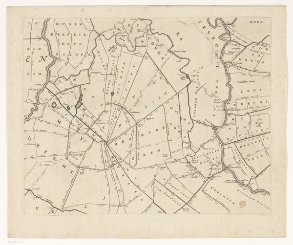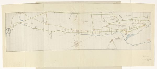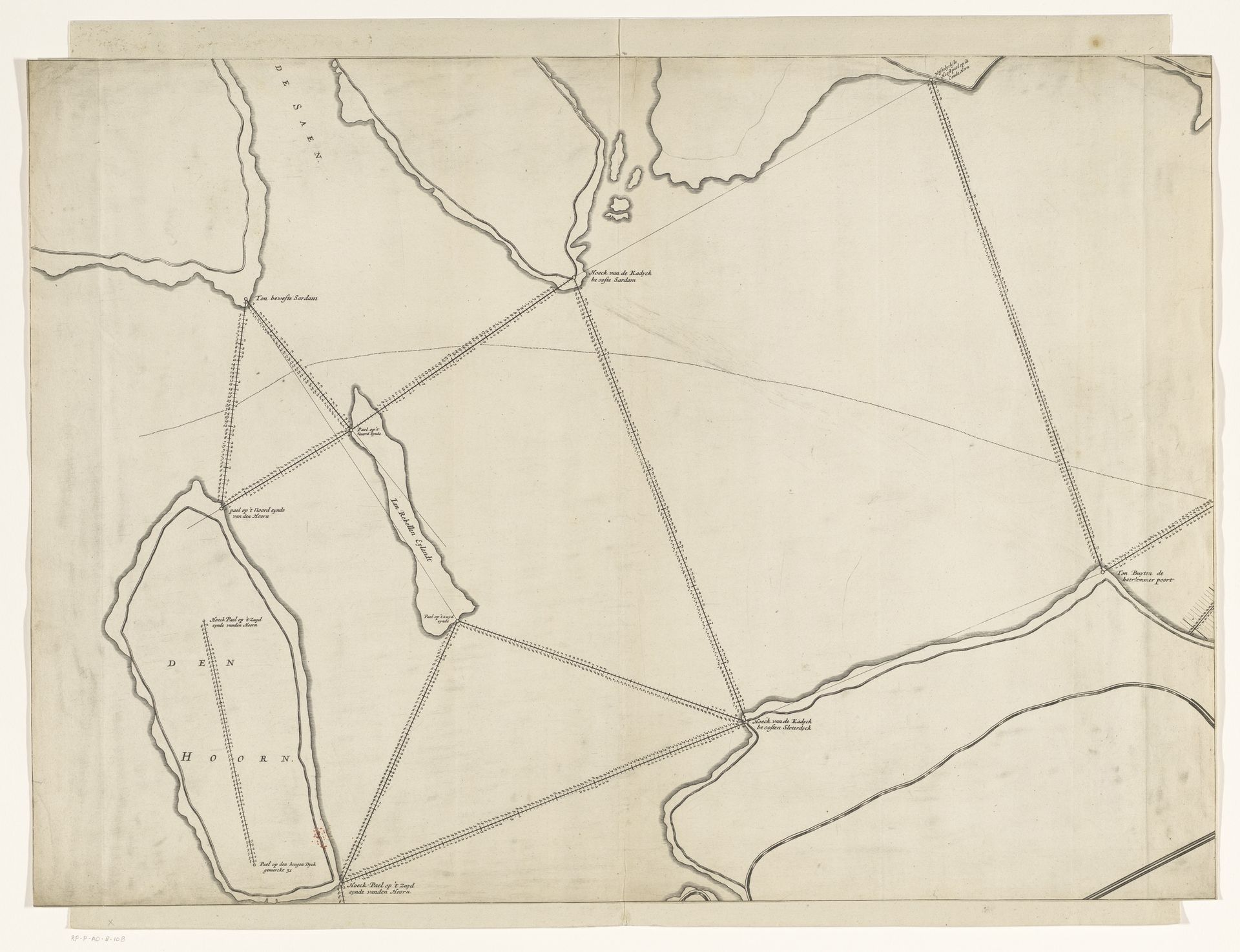
after 1674
Kaart van het IJ, 1674 (linkerdeel)
Listen to curator's interpretation
Curatorial notes
Curator: The drawing before us, "Kaart van het IJ, 1674 (linkerdeel)," or "Map of the IJ, 1674 (left part)," rendered in ink and etching, gives us a bird's-eye perspective of a crucial waterway in the Netherlands. Editor: Immediately striking is its austere geometry. It's less a romantic landscape, more a precisely rendered framework for understanding the region’s geography. The subdued ink adds to its formal nature. Curator: Maps of this period served not only to represent space, but to wield power. Cartography in the 17th century was intricately tied to trade, military strategy, and the establishment of territories. Creating and possessing such a map implied authority and control over that space. Editor: The crisscrossing lines seem almost ritualistic, less about simple distance and more about laying claim. The names carefully inscribed evoke ownership, a sort of visual incantation over the land and water. Does it speak to Dutch mercantile prowess? Curator: Absolutely. The IJ was, and is, vital to Amsterdam's commercial success. This map, while seemingly objective, reinforced Amsterdam's dominant position and influence within maritime trade routes. Think of the Dutch East India Company's expansion during this era. These precise charts facilitated that expansion, documenting navigable waters. Editor: Those lines create a powerful, psychological link to the territory itself. Consider how lines form enclosures and divisions, and dictate the direction of our eyes and thought. This austere map does more than give data; it establishes the very limits of a cultural perspective. Curator: And even this section, the "left part," signals a grander project. We aren't seeing a simple view; rather a section of something larger, alluding to further reach. It indicates ambition, hinting at continuous expansion of the frame of authority. Editor: This "Kaart" is a fascinating symbol then: less a straightforward tool for sailors, more an emblem of the projection of dominance. Looking closely has shown me a complex negotiation of landscape, power, and cultural self-image, encoded in sparse ink lines. Curator: Yes, by delving into the context and examining the map’s inherent symbolism, we move beyond simply noting its visual appearance to consider it as a critical component in constructing a historical narrative. A narrative deeply rooted in political and economic motivations.