print, paper, engraving
#
baroque
# print
#
landscape
#
paper
#
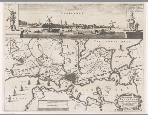
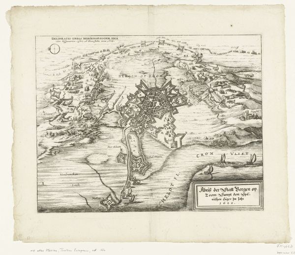
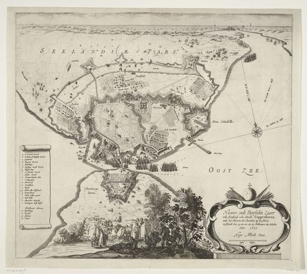
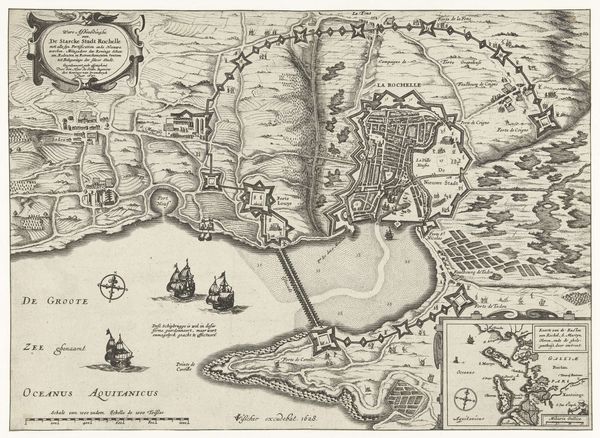
cityscape
#
engraving
Dimensions: height 185 mm, width 247 mm
Copyright: Rijks Museum: Open Domain
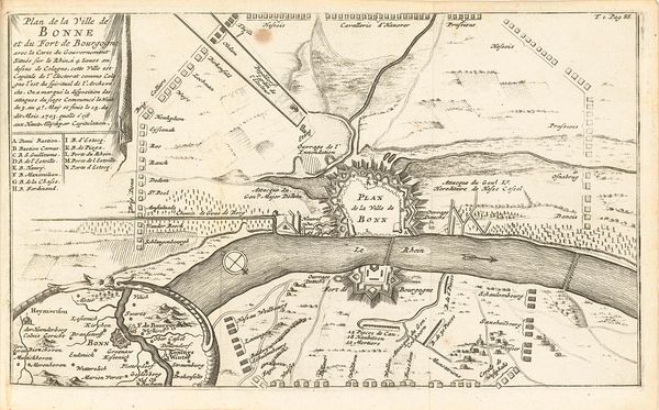
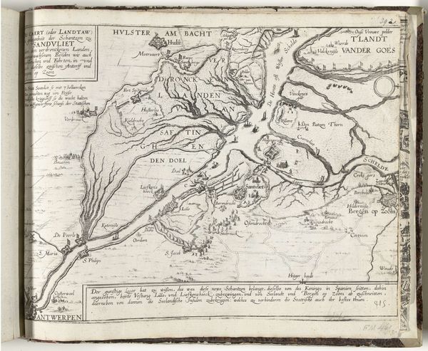
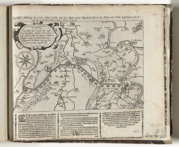
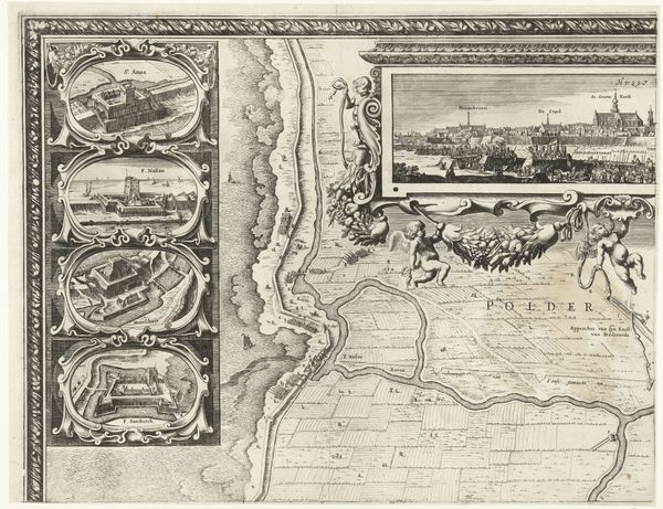
This is an anonymous print from 1703, a schematic rendering of the siege of Bonn, likely intended as a record of a significant military event in the Rhineland. It shows us the formal arrangement of military power, marking out troop positions and fortifications. What’s striking is how this image transforms the chaos and violence of war into a rational, ordered display. This was a period when maps were not just geographical tools, but also instruments of political and military strategy. Bonn's siege occurred during the War of the Spanish Succession, a major European conflict. The print serves as a form of propaganda, turning a bloody siege into an emblem of strategic thinking and control. Understanding this image involves looking at the broader political context and consulting military archives. The image’s value lies in its function as a historical document, reflecting contemporary attitudes toward warfare, power, and geographical representation.
Comments
No comments
Be the first to comment and join the conversation on the ultimate creative platform.
More like this