drawing, print, etching, paper, engraving
#
drawing
#
dutch-golden-age
# print
#
etching
#
landscape
#
paper
#
engraving
Dimensions: height 226 mm, width 269 mm
Copyright: Rijks Museum: Open Domain
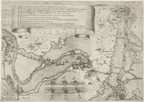
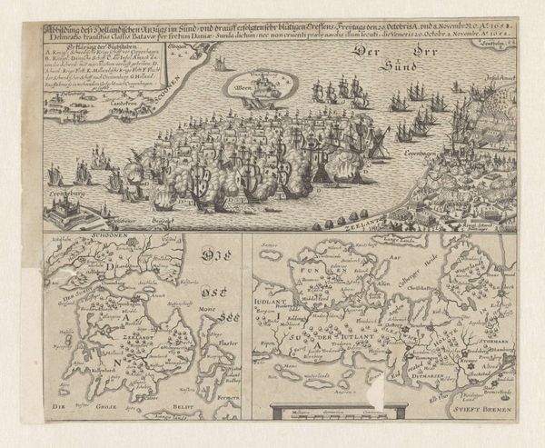
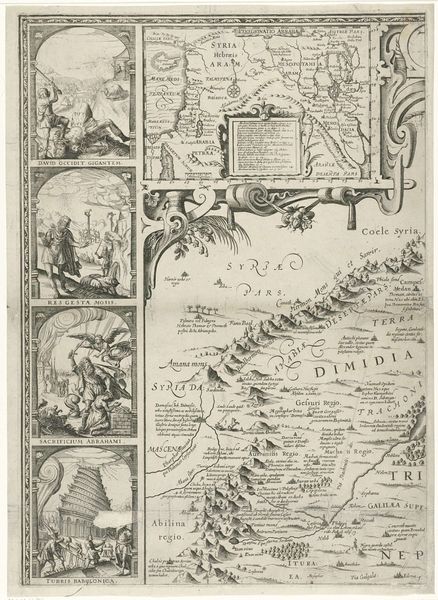
Curator: Welcome to the Rijksmuseum. We're standing before a captivating piece titled "Îles d'Hyères en het fort van Brégançon" by Abraham Allard, dating from around 1701 to 1733. It's a detailed print, employing both etching and engraving techniques. Editor: My first impression is that this piece feels more documentary than artistic. It presents a measured depiction, a landscape viewed not for its beauty, but for the geographical information it conveys. I can almost feel the mapmaker’s hand guiding my eye. Curator: Indeed. Maps like this served practical purposes, assisting in navigation and strategy. However, it transcends mere functionality. Observe how Allard depicts the fortifications; they stand as symbols of power and control, revealing anxieties related to territory and dominion in early modern Europe. Each carefully rendered detail of the land contributes to a broader narrative. Editor: That's a convincing argument! Although it can't be denied that a certain dryness and schematic nature comes from this technical orientation. Even so, I can see how that level of specificity functions compositionally, creating a rich pattern across the whole picture plane through a combination of dense and sparse markings. Curator: Consider, too, the symbolic language of cartography. The ships, for instance, are more than just vessels; they represent trade routes, cultural exchange, and potential conflict. Their position on the map speaks to the importance of maritime power during this period and alludes to larger narratives involving commerce and warfare. The landmass itself stands for an enduring sense of home and possession. Editor: From a purely formal perspective, I find the juxtaposition of miniature cityscapes above the main landscape quite intriguing. The use of different orientations and perspectives helps give visual interest as well as important keys and location details that emphasize the geographic purpose here. These details emphasize cartographic intention through geometric relationships. Curator: Reflecting on this image, one finds a synthesis between utility and symbolic representation, telling us much about the cultural values of the Dutch Golden Age. Editor: Ultimately, while I admire the historical and semiotic density of Allard’s piece, I will stick with my emphasis on how the structure of it all conveys valuable and insightful understanding!
Comments
No comments
Be the first to comment and join the conversation on the ultimate creative platform.
More like this