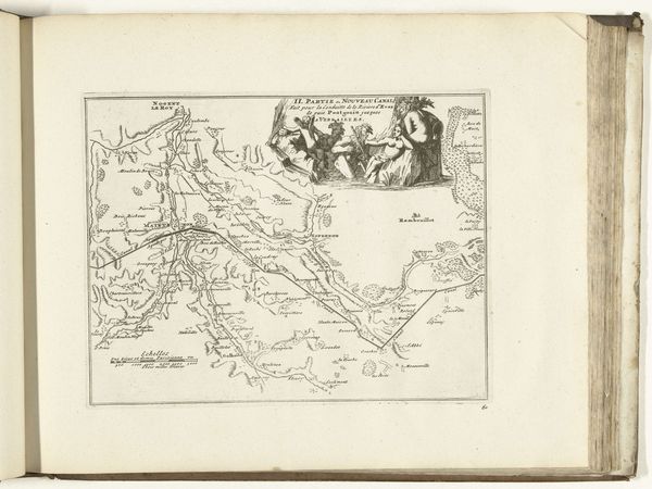
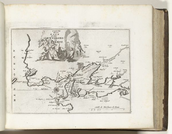
Kaart van het nieuwe kanaal van Pontgouin naar Versailles (deel II), ca. 1702 1702 - 1703
0:00
0:00
anonymous
Rijksmuseum
drawing, print, ink, engraving
#
drawing
#
baroque
# print
#
landscape
#
ink
#
line
#
cityscape
#
academic-art
#
engraving
Dimensions: height 205 mm, width 265 mm
Copyright: Rijks Museum: Open Domain
This map, "Kaart van het nieuwe kanaal van Pontgouin naar Versailles (deel II)", was made around 1702 by an anonymous artist. The engraving presents us with a network of waterways, a cartographic rendering defined by the stark contrast of lines against the paper's pale ground. The visual experience is cool and precise, evoking a sense of engineered control over nature. The composition divides into two distinct zones: the functional map below and an allegorical scene above. This duality reflects a tension between the practical application of the canal and its symbolic significance as a display of royal power. The allegorical scene, with its classical figures, elevates the canal project to the realm of myth. Consider the lines here - each one defining not just geography, but also power and ambition. The artist uses this formal division to underscore how human intervention reshapes both the physical landscape and cultural narratives. This engraving challenges the fixed representation of space, inviting ongoing interpretation.
Comments
No comments
Be the first to comment and join the conversation on the ultimate creative platform.
More like this