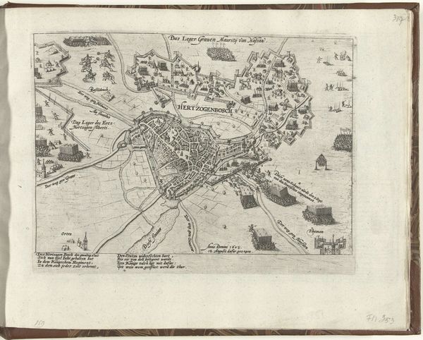
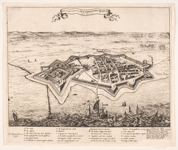
Plattegrond van Deventer, veroverd door de bisschop van Munster in 1672 1672
0:00
0:00
gasparbouttats
Rijksmuseum
drawing, print, pen, engraving
#
drawing
#
dutch-golden-age
#
mechanical pen drawing
# print
#
pen illustration
#
pen sketch
#
old engraving style
#
personal sketchbook
#
pen-ink sketch
#
pen work
#
sketchbook drawing
#
pen
#
cityscape
#
storyboard and sketchbook work
#
sketchbook art
#
engraving
Dimensions: height 192 mm, width 254 mm
Copyright: Rijks Museum: Open Domain
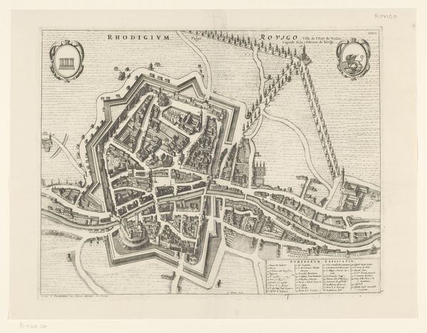
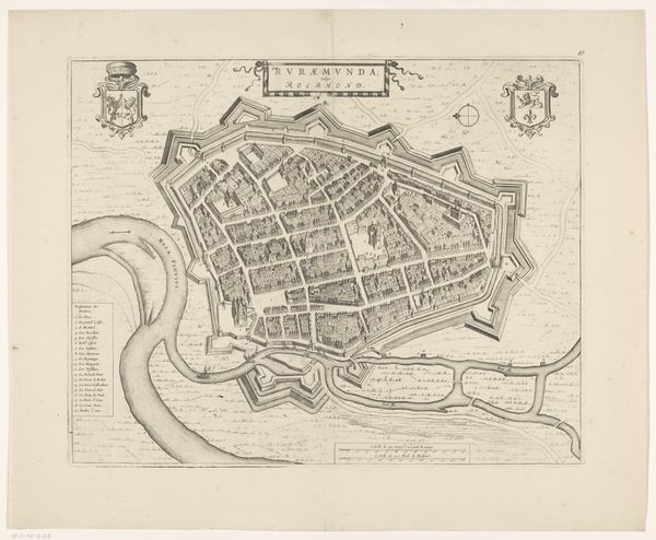
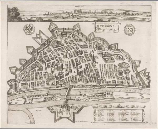
This is Gaspar Bouttats’s “Map of Deventer, conquered by the Bishop of Munster in 1672,” made with etching on paper. The etched lines capture the layout of the city, surrounded by its fortifications, with an almost photographic precision. Yet the act of etching itself, using acid to bite lines into a metal plate, speaks to the social context of the print. It was a means of mass production, allowing for the wide distribution of images and information. Look closely, and you'll notice the incredible detail, from the tiny buildings within the city walls to the ships sailing on the river. This reflects the immense amount of work involved in producing such a map. The social and political realities of the 17th century are etched into this surface, a testament to the labor, skill, and ambition that went into shaping our world.
Comments
No comments
Be the first to comment and join the conversation on the ultimate creative platform.
More like this