print, etching, engraving
#
dutch-golden-age
# print
#
etching
#
cityscape
#
engraving
Dimensions: height 270 mm, width 357 mm
Copyright: Rijks Museum: Open Domain
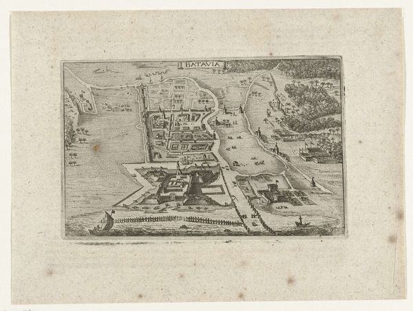
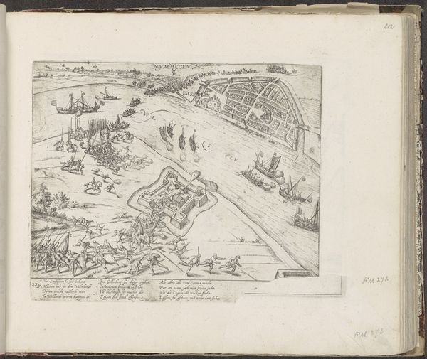
This is an anonymous map of Batavia, now Jakarta, rendered with ink on paper. The visual field is dominated by a high-angle view of the city, its gridded streets and orthogonal structures creating a rigid, rational order. The detailed execution and stark contrast between the built environment and the natural elements—the sea, river, and vegetation—serve to emphasize the imposition of human will over nature. The map functions as a semiotic system. Each line, shape, and label acts as a signifier, pointing to a specific aspect of the city's infrastructure and organization. The composition suggests a clear hierarchy, with the fortified city center occupying the most visually dense area, illustrating power and control. Consider how this detailed cartographic representation challenges fixed notions of space and representation. The map invites us to critically examine the codification and control inherent in urban planning and spatial representation, revealing deeper ideological structures at play in the construction and perception of the colonial city.
Comments
No comments
Be the first to comment and join the conversation on the ultimate creative platform.
More like this