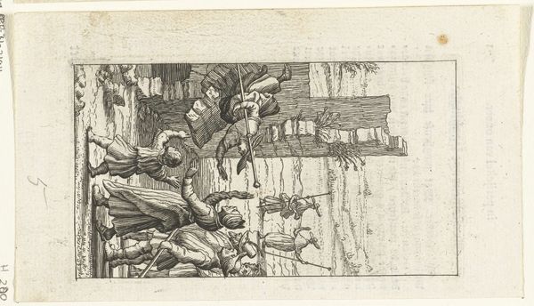
Plattegrond van de Kaart Figuratief van Delft (deel linksboven) 1678 - 1752
0:00
0:00
johannesderam
Rijksmuseum
print, engraving
#
dutch-golden-age
# print
#
cityscape
#
engraving
Dimensions: height 375 mm, width 650 mm
Copyright: Rijks Museum: Open Domain
This is a section of Johannes de Ram’s detailed map of Delft, made sometime before his death in 1693. At first glance, it’s an objective rendering of the city, yet it embodies the intersections of power, identity, and commerce inherent in the Dutch Golden Age. Look closely, and you’ll notice the intricate details – the precise arrangement of buildings, the waterways that facilitated trade, and the coats of arms which signify civic and aristocratic power. These elements reflect not just the layout of the city, but also its social hierarchy and economic activities. Delft, at the time, was a hub of the Dutch East India Company. The map invites you to consider whose stories are being told. While it depicts the city's infrastructure and governance, it silently acknowledges the lives and labor that sustained it, from the merchants who amassed fortunes to the sailors and tradespeople whose hard work fueled the economy. It leaves you to consider what is included, and more importantly, what remains invisible.
Comments
No comments
Be the first to comment and join the conversation on the ultimate creative platform.
More like this