drawing, graphic-art, print, paper, ink, engraving
#
drawing
#
graphic-art
#
aged paper
#
dutch-golden-age
# print
#
old engraving style
#
paper
#
ink
#
pen-ink sketch
#
ink colored
#
pen work
#
engraving
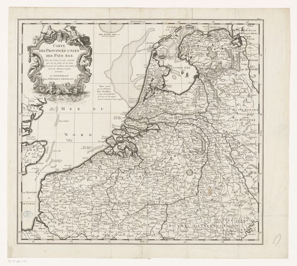
Dimensions: height 465 mm, width 568 mm
Copyright: Rijks Museum: Open Domain
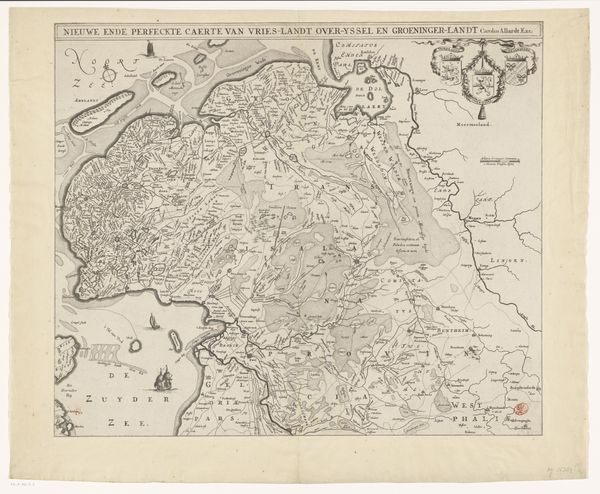
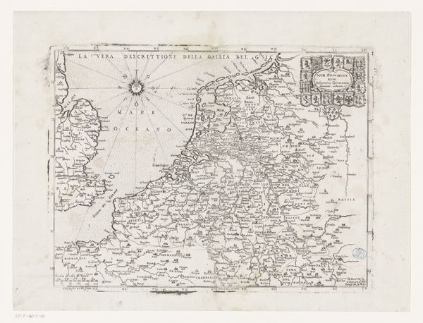
This is an undated map of the Seventeen Provinces, made by an anonymous artist and printed on paper. The map’s visual impact lies in its dense network of lines and intricate details. The composition presents a carefully structured overview of geographical territories, rendered in a style that emphasizes precision. Line, as a formal element, is crucial here. It not only defines borders and waterways but also guides the viewer's eye across the landscape. The overall effect is a tapestry of information where each province is delineated, yet connected to the whole. The map’s structure implies more than just geography; it reflects a particular vision of political and cultural space. It is a semiotic system, where each symbol – the coats of arms, the compass rose, and the lettering – carries meaning. In its totality, the map invites us to consider how territories are constructed and perceived. How does it encourage viewers to think about the spatial relationships between regions, and how these might influence notions of identity and power? It questions fixed meanings associated with geographical boundaries and encourages ongoing interpretation.
Comments
No comments
Be the first to comment and join the conversation on the ultimate creative platform.
More like this