print, engraving
#
aged paper
#
baroque
# print
#
cityscape
#
history-painting
#
engraving
Dimensions: height 492 mm, width 738 mm
Copyright: Rijks Museum: Open Domain
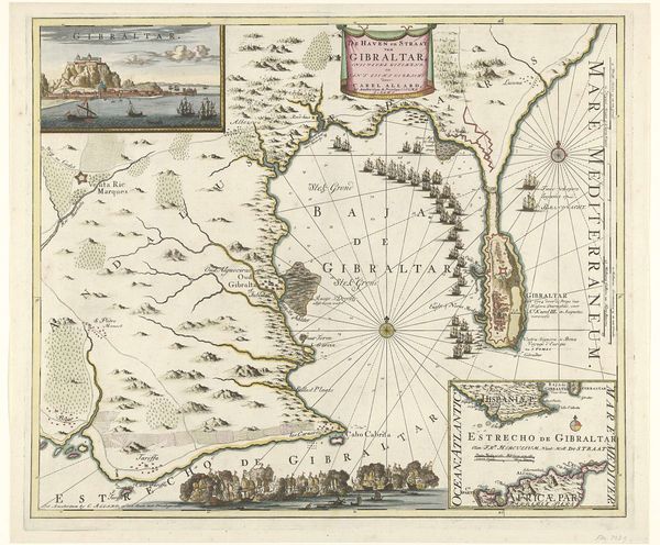
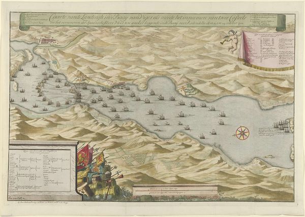
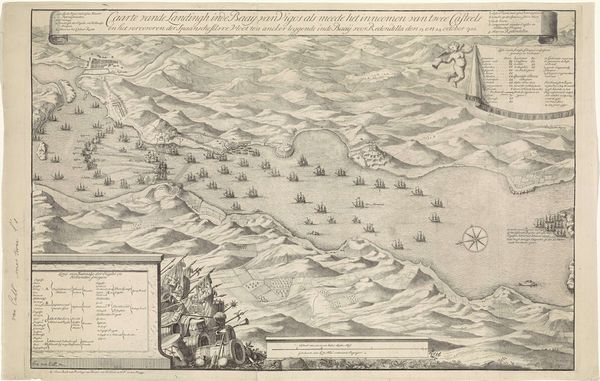
This map of the Allied landing near Cadiz was made around 1702 by Jan van Call, using ink and watercolor on paper. As a drawn and painted object, this map comes out of a long tradition of craftsmanship. The relatively high level of detail suggests it was created through close observation. The many sailing ships, drawn in profile, indicate the importance of naval power at this time. Looking closely, we can appreciate the meticulous labor involved in producing this document: the careful rendering of place names, topographical features, and even the decorative embellishments in the corners. Maps such as this one also served a crucial function in the age of exploration and colonization. Cartography was essential to military planning, and to the establishment of trade routes. The amount of work involved in the process reflects its purpose and the context of geopolitical strategy and global commerce. So, while this may seem like a work of art, it is also a product deeply embedded in the socio-economic landscape of its time.
Comments
No comments
Be the first to comment and join the conversation on the ultimate creative platform.
More like this