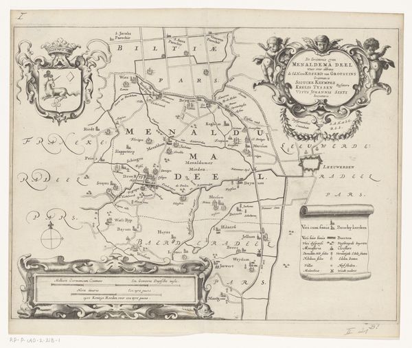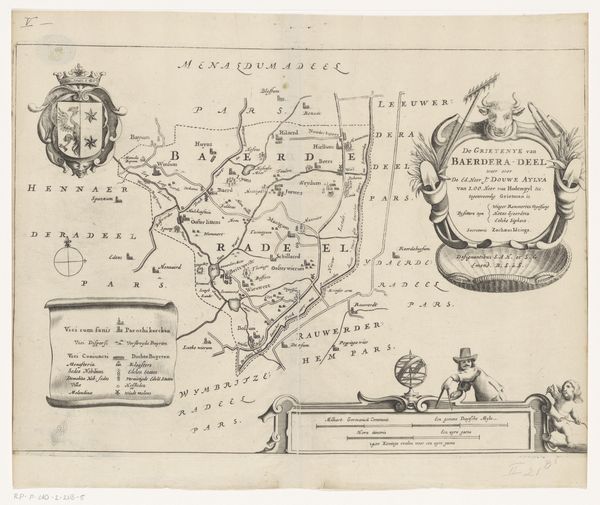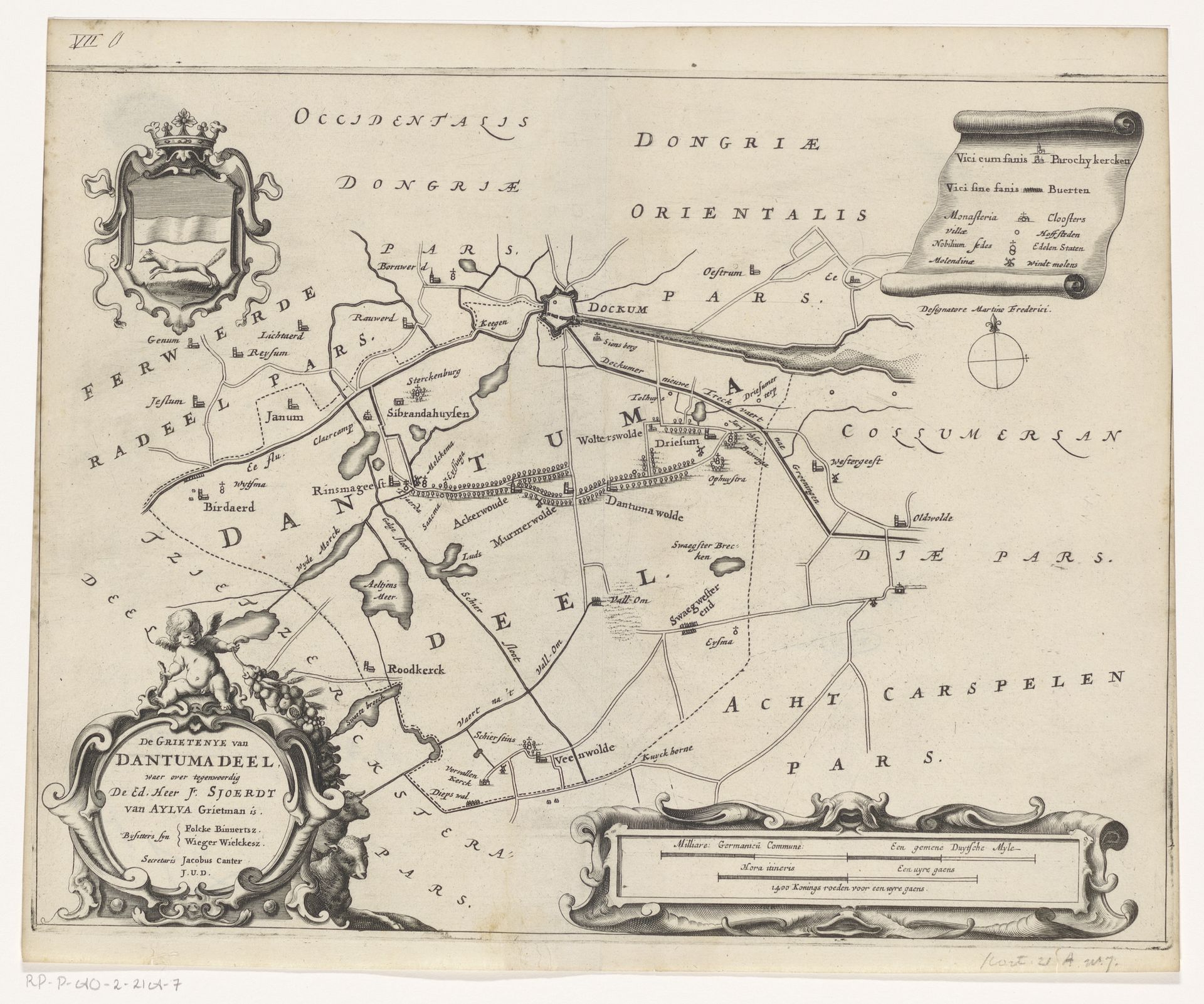
1664
Kaart van de grietenij Dantumadeel
Jacob van Meurs
1620 - 1680Location
RijksmuseumListen to curator's interpretation
Curatorial notes
Editor: So, this is Jacob van Meurs' "Kaart van de grietenij Dantumadeel" from 1664, currently held at the Rijksmuseum. It’s an engraved map with pen and ink – it’s so detailed. It gives me a real sense of the historical landscape, almost like looking through a time machine. What strikes you most when you look at this map? Curator: What immediately stands out to me is not just the geographical information, but the map's role as a form of power and knowledge. Maps like these, commissioned by figures like Sjoerdy mentioned in the lower cartouche, were instruments in establishing control over territory and resources. How do you think the people commissioning and viewing this map understood their place in the world? Editor: That’s a really interesting point! I guess for the commissioner, it was about solidifying their authority and visually representing their domain, but what about ordinary viewers? Curator: For ordinary viewers, especially those within the depicted region, it likely fostered a sense of belonging and collective identity within Dantumadeel. Notice the emphasis on delineating borders, listing towns and villages, and the symbolic imagery included, like the coat of arms. These elements contribute to a shared understanding of the territory and its people. But were maps necessarily accurate, or always neutral? Editor: I suppose not, since maps often reflect the worldview of those who created them and held power, shaping public perception of these regions and, as you said, staking claims. I never thought of maps that way. Curator: Precisely! They are both documents and statements, tools used to create and reinforce socio-political landscapes, prompting one to ponder the true function and meaning that historical maps have, especially during the Dutch Golden Age. Editor: This has completely changed how I see historical maps. I’ll definitely approach them with a more critical eye now, thinking about the context of power and control, instead of just seeing them as objective representations of the land.