drawing, print, ink, engraving
#
drawing
#
baroque
# print
#
landscape
#
ink
#
geometric
#
engraving
Dimensions: height 142 mm, width 215 mm
Copyright: Rijks Museum: Open Domain
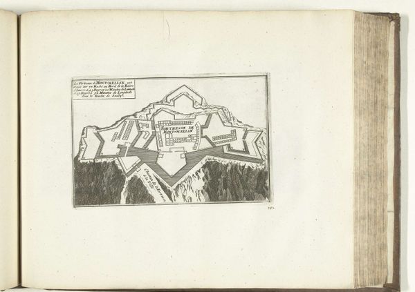
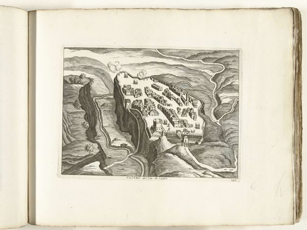
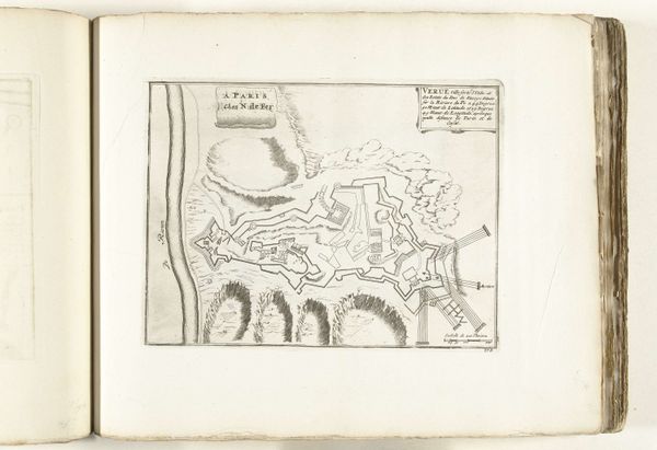
This is an anonymous print from around 1702, showing a bird's-eye view of the fortress of Montmélian. It offers a glimpse into the military strategies and territorial concerns of early 18th-century Europe. The fortress, depicted with precise geometric lines, sits atop a craggy mountain. This kind of design reflects the era's emphasis on strategic defense, and the detailed rendering suggests the importance of cartography in military planning. Made during the War of the Spanish Succession, this image underscores the period’s intense geopolitical rivalries, with France and Austria vying for control over territories like Montmélian, which was then part of Savoy. Military maps of this kind served both practical and symbolic functions, informing military campaigns, and asserting territorial claims. Understanding the history and purpose of images like these requires us to consult diverse archival sources: military records, diplomatic correspondence, and topographical surveys, each shedding light on the social and institutional forces that shaped their creation.
Comments
No comments
Be the first to comment and join the conversation on the ultimate creative platform.
More like this