drawing, print, etching, ink, engraving
#
pen and ink
#
drawing
#
dutch-golden-age
# print
#
etching
#
landscape
#
ink
#
geometric
#
geometric-abstraction
#
cityscape
#
engraving
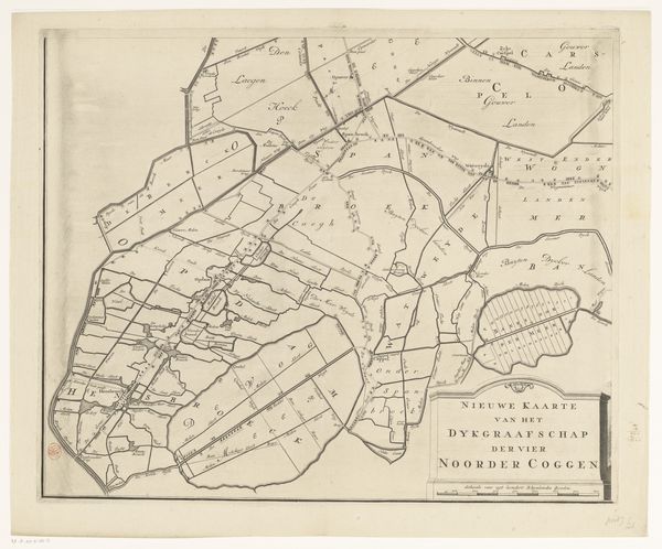
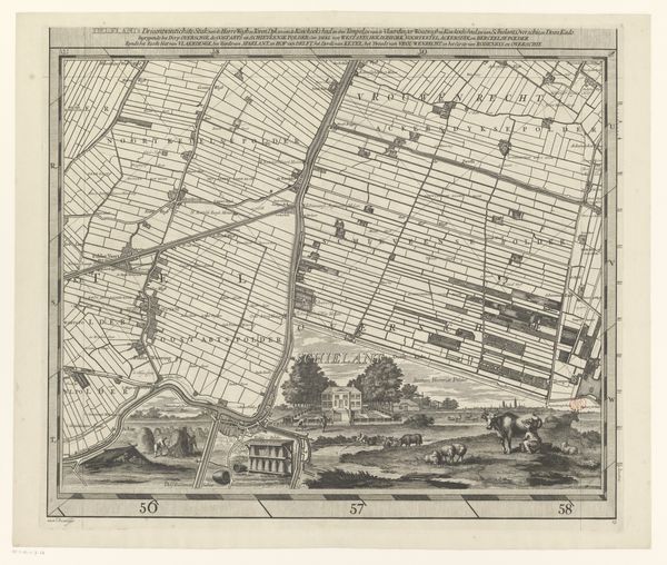
Dimensions: height 484 mm, width 623 mm
Copyright: Rijks Museum: Open Domain
This is a section of Gilliam van der Gouwen's map of the Ring of Putten, created sometime before 1740 using engraving. The network of grey lines articulates spaces like fields or administrative regions. The image is defined by its ordered, segmented composition. Consider the arrangement of shapes. The grid structure, which feels logical, quickly leads to variations in shape sizes and orientations. It appears to mirror systems of power through the division of land, yet it also generates a kind of abstract visual game. The map presents a series of signs that demand interpretation. What do these symbols reveal about the relationship between people and the land? The neutral tone invites us to consider the map's construction and how its formal elements might destabilize any singular reading. This map, therefore, becomes an exercise in seeing how even seemingly objective representations are shaped by form and structure. It presents ongoing interpretative possibilities rather than any fixed meaning.
Comments
No comments
Be the first to comment and join the conversation on the ultimate creative platform.
More like this