print, engraving
#
baroque
# print
#
cityscape
#
engraving
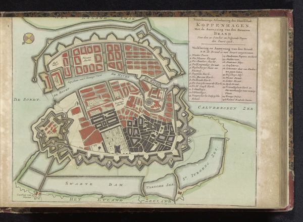
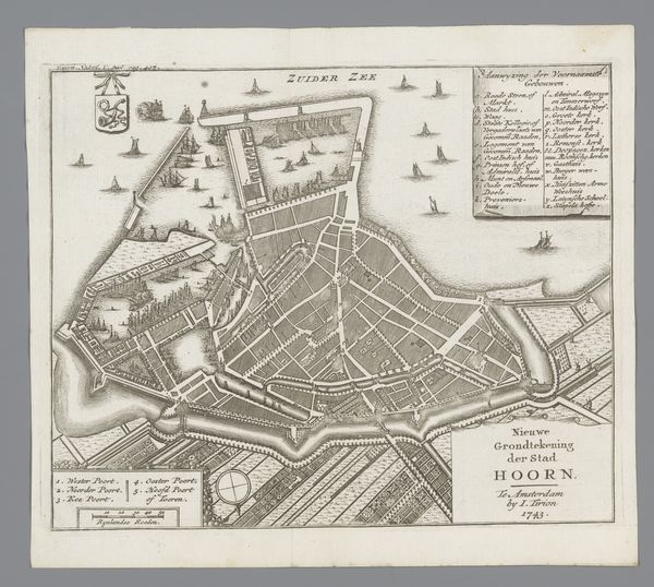
Dimensions: height 563 mm, width 843 mm
Copyright: Rijks Museum: Open Domain
This is an old city map of Copenhagen. It's an aerial view, meticulously rendered with fine lines and a predominantly neutral palette, save for a section highlighted in yellow. This formal arrangement offers a structured, almost diagrammatic representation of urban space. The map's visual structure, with its geometric shapes defining buildings and fortifications, resonates with structuralist ideas about underlying orders. Each line and shape acts as a signifier within a semiotic system, conveying specific information about the city's layout and defenses. The city’s organization into quarters, labeled and listed along the sides, imposes an order and categorization of urban space. But the map also poses questions. What is the function of the yellow section? Does it indicate a strategic location, a place of importance, or something else? The map disrupts any fixed reading, inviting multiple interpretations and emphasizing that representation is never a neutral act. The emphasis on geometric precision speaks to the philosophical concerns of its time. The map’s aesthetic is not merely decorative, but a cultural artifact reflecting how the city was perceived, understood, and controlled.
Comments
No comments
Be the first to comment and join the conversation on the ultimate creative platform.
More like this