print, etching
#
dutch-golden-age
# print
#
etching
#
landscape
#
geometric
#
cityscape
Dimensions: height 175 mm, width 216 mm
Copyright: Rijks Museum: Open Domain
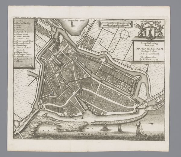
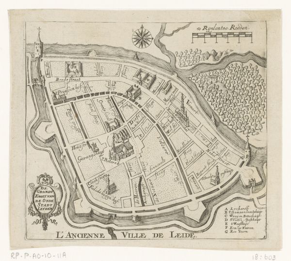
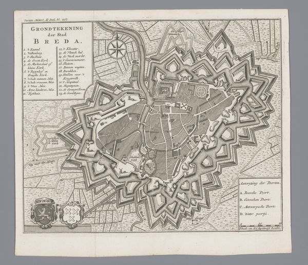
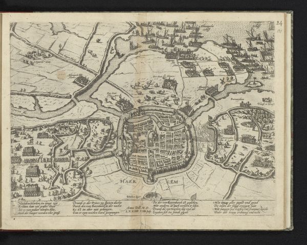
This is an engraved map of Hoorn, a city in the Netherlands, made in Amsterdam in 1743 by an anonymous artist. It's titled "New Ground Plan of the City of Hoorn," and was published by I. Tirion. The map gives us insight into Hoorn's urban layout and defensive structures during the 18th century, as well as the socio-economic activities. Notice the detailed rendering of the city's architecture, including the fortifications that reflect its strategic importance for trade. The Zuiderzee location was key for naval power. This kind of cartographic representation was not just about geographical accuracy; it was also about power and control. It was a means for the Dutch Republic to assert its dominion over its territories and project its influence abroad, which was largely built on institutional structures of trade and governance. To better understand the context of this image, we might consult archives of the Dutch East India Company, travelogues, and contemporary accounts of life in Hoorn. These resources, coupled with a close reading of the map, provide a window into the social and political realities of the Dutch Golden Age.
Comments
No comments
Be the first to comment and join the conversation on the ultimate creative platform.
More like this