print, engraving
old engraving style
perspective
geometric
cityscape
history-painting
engraving
Dimensions: height 235 mm, width 345 mm
Copyright: Rijks Museum: Open Domain
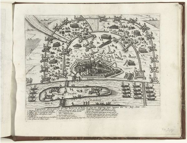
This is an anonymous plan of Bern made in 1726. The crisp lines and detailed hatching give the city a tangible presence despite the aerial view. The composition is dominated by the city's fortifications on the left, balanced by the sweeping arc of the Aare River. Let's consider this map as a structured system. Each line, each mark, functions as a signifier. The fortifications, for example, aren't just defensive structures; they signify power and control. The river, too, is not merely a geographical feature but a border, a boundary that defines and protects the city. Look closely at the rendering of space. The map employs a pre-photographic, almost diagrammatic perspective. This creates a sense of order, reducing the city to a set of comprehensible signs. It's a representation striving for objectivity, yet inherently subjective in its choices of what to include and how to represent it. Ultimately, this map is not just a depiction of Bern but a carefully constructed image reflecting the values and concerns of its time. It's an invitation to decode the urban space through the language of lines, shapes and symbolic representation.
Comments
No comments
Be the first to comment and join the conversation on the ultimate creative platform.