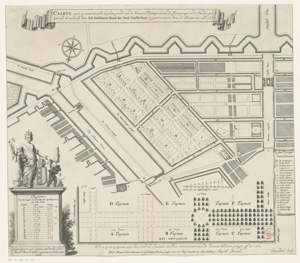
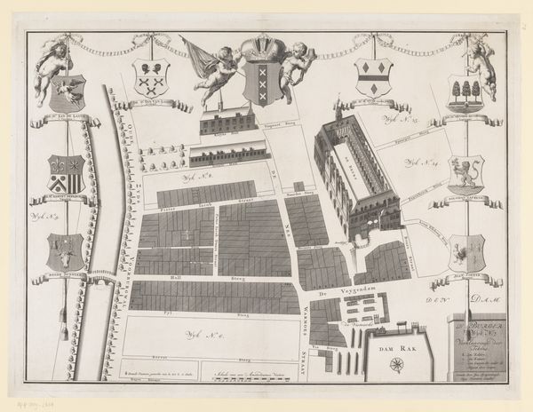
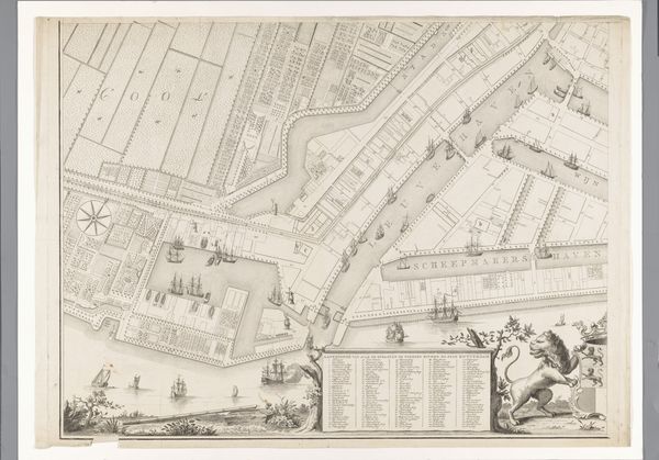
Plattegrond met ontwerp voor de Nieuwe Plantage te Amsterdam 1725 - 1731
0:00
0:00
bastiaenstopendael
Rijksmuseum
drawing, print, engraving, architecture
#
architectural sketch
#
drawing
#
dutch-golden-age
# print
#
architectural plan
#
geometric
#
architectural drawing
#
architecture drawing
#
architectural proposal
#
cityscape
#
engraving
#
architecture
Dimensions: height 351 mm, width 400 mm
Copyright: Rijks Museum: Open Domain
This is Bastiaen Stopendael’s ‘Map with design for the Nieuwe Plantage in Amsterdam’, an ink drawing from the late 17th century, currently held at the Rijksmuseum. The drawing is a careful orchestration of geometric forms, the network of straight lines divides the drawing into precise sections. The uniformity of the layout suggests an attempt to impose order, reflecting the period’s fascination with rational design. The map's rigid structure invites us to consider urban planning not just as practical, but as an expression of control. The map's composition presents an urban fantasy, yet the very precision with which it's rendered makes us question this ideal. What social dynamics are suppressed by this strict order? How might lived experience disrupt this planned perfection? The drawing serves as a reminder that maps aren’t neutral; they encode choices, values, and visions of how society should be structured.
Comments
No comments
Be the first to comment and join the conversation on the ultimate creative platform.
More like this