#
comic strip sketch
#
aged paper
#
page thumbnail
#
parchment
#
old engraving style
#
etching
#
retro 'vintage design
#
personal sketchbook
#
old-timey
#
storyboard and sketchbook work
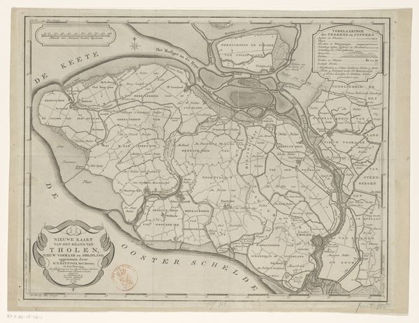
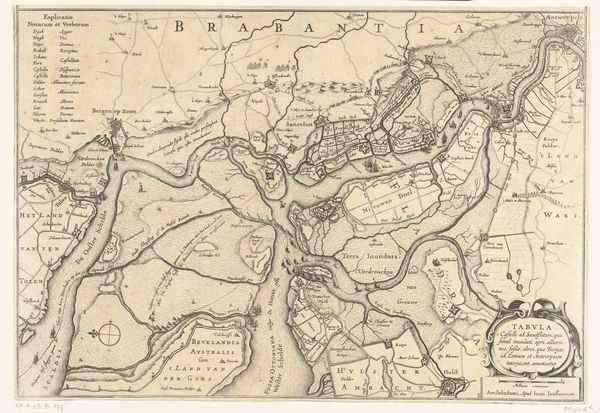
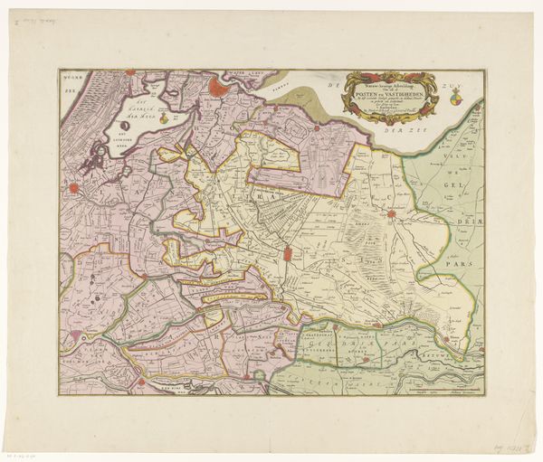
Dimensions: height 566 mm, width 672 mm
Copyright: Rijks Museum: Open Domain
Editor: This is "Kaart van het eiland Zuid-Beveland," a map of the island of Zuid-Beveland, possibly from 1748, by David Willem Carel Hattinga. It's rendered with what looks like etching on aged paper. The detail is quite impressive, almost overwhelming at first glance. What stands out to you when you look at this? Curator: What interests me immediately is the intersection of labor and representation. This map wasn't just *drawn*; it was etched, printed, likely hand-colored, and distributed. Each of those steps involved different skilled laborers, reflecting a whole production process. How did this division of labor affect the accuracy or even the perspective of the map itself? Was it intended for purely navigational use, or was there a propagandistic or aesthetic dimension at play as well? Editor: That's fascinating. I hadn't considered the different hands involved in its creation. I was more focused on the final product, this kind of antique, almost romantic vision of a place. Curator: Precisely! And consider the materials. Paper wasn't cheap. The pigments would have been carefully sourced. These weren’t neutral choices. The decision to present the information on high-quality paper, with fine etching, suggests this map wasn’t for everyone. It speaks to the social and economic status of its intended consumer. Do you see any particular symbols that might tell us more? Editor: Well, I see what appears to be a compass rose; the text is largely in Latin, and it denotes specific settlements…I guess these could signal the map's intent as official record. Curator: Right. By understanding the resources, the process, the hands involved, and who was able to access this object, we gain insight into the social context of 18th-century cartography and knowledge dissemination. Editor: This really makes me think about how maps can be so much more than just geographic tools, especially given the laborious production practices and specialized artisanal skill. Curator: Exactly. Materiality informs meaning, always.
Comments
No comments
Be the first to comment and join the conversation on the ultimate creative platform.
More like this