drawing, print, paper, ink, engraving
#
drawing
#
aged paper
#
baroque
# print
#
pen sketch
#
sketch book
#
landscape
#
paper
#
personal sketchbook
#
ink
#
pen-ink sketch
#
pen and pencil
#
pen work
#
sketchbook drawing
#
cityscape
#
history-painting
#
storyboard and sketchbook work
#
sketchbook art
#
engraving
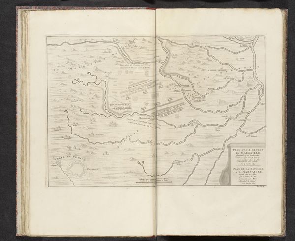
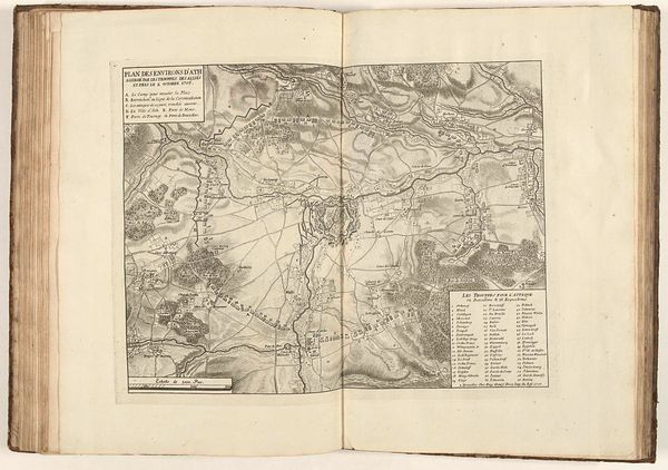
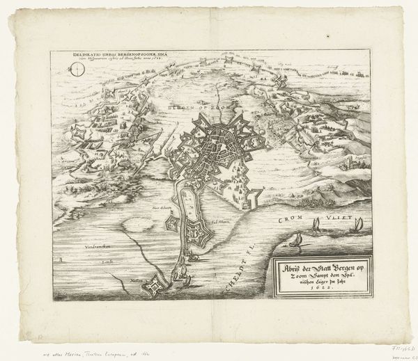
Dimensions: height 439 mm, width 465 mm
Copyright: Rijks Museum: Open Domain
This is an anonymous rendering of the battle of Toulon from 1707, an engraving in the Rijksmuseum. Immediately striking is the map’s composition, organized around a central fortified structure of Toulon, which dictates how we navigate the scene. The lines are precise, creating a meticulous depiction of military positioning and geographical features. Mountains rise in the background, depicted with short hatch marks, contrasting with the smoother rendering of the sea. The map functions as a symbolic representation, not just of space, but of power and strategy. Each line, each labeled point, is a signifier in a complex semiotic system designed to convey military intelligence. The formal precision lends an air of authority, yet the very act of mapping introduces a degree of abstraction. It distances us from the visceral experience of battle. Consider how the map encourages a reading of space as a site of conflict, structured and rationalized for strategic purposes. In this way, the engraving performs as both an aesthetic object and a tool of geopolitical understanding.
Comments
No comments
Be the first to comment and join the conversation on the ultimate creative platform.
More like this